
3D Modeling for Construction Projects: From Design to Reality
In the fast-paced world of construction, ensuring that every detail of a project is meticulously planned is crucial for success. As construction projects become more complex, the need for advanced tools to visualize and plan every aspect of a build becomes increasingly important. This is where 3D modeling comes into play.
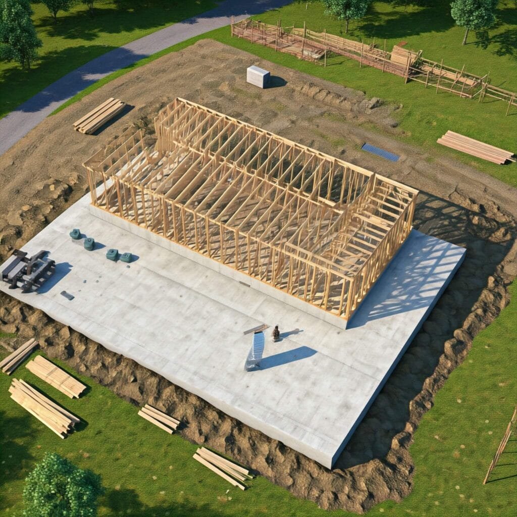
3D modeling has revolutionized the way construction professionals approach design and planning. Using sophisticated software, 3D models provide a realistic and detailed view of a project before any physical work begins. Southwest Drone Tech specializes in providing 3D modeling services for construction projects across Tucson, Phoenix, and Arizona, helping developers, architects, and contractors bring their designs to life with accurate, visual representations.
What is 3D Modeling in Construction?
3D modeling in construction refers to the use of computer-generated visualizations to create digital representations of buildings, structures, or landscapes. These models can be highly detailed, showing everything from the layout of a building’s rooms to the landscape around it, down to the last window and door.
The 3D models are built from digital data collected from drones along with other data collection methods and can be used to create realistic renderings of the planned construction project. This allows stakeholders to visualize the final outcome and make informed decisions early in the process. For projects in Tucson, Phoenix, and Arizona, Southwest Drone Tech provides high-quality 3D models that are vital for efficient project planning and execution.
Why 3D Modeling is Essential for Construction Projects
- Enhanced Visualization One of the biggest benefits of 3D modeling is its ability to provide a clear, detailed visualization of a construction project. With 3D models, contractors and clients can see the project in three dimensions, making it easier to understand spatial relationships and design elements. This visualization helps ensure that everyone involved—from the architect to the contractor—has the same understanding of the design, reducing the chance of miscommunication.
- Improved Decision-Making By having access to highly accurate 3D models, construction teams can make better, data-driven decisions. The models can highlight potential problems such as spatial conflicts, structural issues, or design flaws early in the planning phase. This helps to address concerns before construction begins, saving both time and money by preventing costly revisions or delays.
- Faster Design Iterations With traditional construction design methods, revisions could take weeks to implement. With 3D modeling, changes can be made quickly and efficiently, allowing design teams to experiment with different layouts, materials, and features in real-time. This results in faster turnaround times and the ability to test various options before settling on the final design.
- Accurate Pre-Construction Planning 3D models give construction professionals the opportunity to simulate the construction process. They can use the model to plan logistics, such as material delivery routes, equipment placement, and crew coordination. This level of detail helps ensure that the construction process runs smoothly from start to finish.
- Collaboration and Communication 3D modeling enhances collaboration among all stakeholders in a construction project. Architects, engineers, contractors, and even clients can access the same model, making it easier to discuss changes, review progress, and identify challenges. This shared digital platform improves communication and helps keep projects on track.
The Growing Role of Drones
Drones are rapidly changing the way construction projects are planned and executed. According to a market analysis on drones in construction, the construction industry is one of the fastest-growing sectors for drone adoption. As the technology advances, drones are not only improving efficiency but also enhancing safety, reducing costs, and offering invaluable data for decision-making.
From aerial photography and video for project tracking to creating highly detailed 3D models for design visualization, drones are proving to be indispensable. This market analysis emphasizes how drone technology is reshaping the construction landscape, highlighting its growing application across various project stages. By leveraging drones for site inspections, progress monitoring, and data collection, construction professionals can streamline operations and ensure more accurate, timely project outcomes.
Applications of 3D Modeling in Construction
3D modeling can be used throughout every stage of a construction project, from initial design to final execution:
- Conceptual Design: Create early-stage visualizations of the project to communicate ideas and concepts to clients, stakeholders, or investors.
- Detailed Design: Refine the model with accurate dimensions, materials, and structural details to guide the building process.
- Construction Simulation: Use 3D models to simulate the construction process, helping teams plan and coordinate each step.
Post-Construction Analysis: Once the project is complete, 3D models can be used to document the finished structure and inform future maintenance or renovations.
What's Next? How Southwest Drone Tech Can Elevate Your Projects
3D modeling is transforming the construction industry by providing professionals with a vital tool for planning, design, and project execution. With realistic and detailed visualizations, 3D models help construction teams identify potential issues early, make informed decisions, and streamline processes. Southwest Drone Tech’s expert 3D modeling services are key to enhancing your construction projects, ensuring accuracy and efficiency from start to finish.
We offer drone construction services across Tucson, Phoenix, and throughout Arizona, including weekly and monthly progress updates, high-quality aerial photos and videos, and promotional materials for company branding. Our comprehensive range of services includes:
- Aerial photography and videography for stunning visuals of your construction site
- Mapping and modeling for precise, detailed 3D representations
- Inspections for solar, HVAC, and other infrastructure assessments
- Video editing to create professional marketing content
- Advertising and marketing videos to promote your project or company
At Southwest Drone Tech, we combine advanced drone technology and professional 3D modeling to improve the planning, design, and execution of your construction projects. Whether you need ongoing progress updates or promotional videos, we’re here to bring your vision to life.
For more information or to schedule your 3D modeling service, contact Southwest Drone Tech today!
Disclaimer: Southwest Drone Tech does not interpret the data collected. We specialize in gathering and presenting high-quality data through advanced drone technology and 3D modeling. For analysis and interpretation, we recommend working with your project’s architects, engineers, or other relevant professionals.
Southwest Drone Tech LLC Disclaimer
While Southwest Drone Tech LLC excels in aerial data collection, it is important to note that we do not provide interpretations of survey-grade information. For projects where precise measurements are essential, you must consult a licensed land surveyor or survey engineer. We can collaborate with your surveyor to supply valuable data, but our services do not replace the need for a licensed land surveyor in any jurisdiction.
We do offer visual markers or outlines of property areas in our imagery as part of our packages; however, these are for general visual reference only and are not legally binding or survey-grade. This standard applies universally to all drone data collection services unless they employ a licensed surveyor. We do not provide formal boundary delineations for home lots (whether developed or undeveloped) intended for sale due to these limitations.