
Drone Services for Agriculture
In Arizona’s agricultural landscape, precision and efficiency are essential for maximizing yields and reducing costs. At Southwest Drone Tech, we provide specialized drone services that transform how farms, vineyards, and agricultural operations monitor and manage their fields. Using cutting-edge drone technology, we deliver high-resolution imagery, detailed mapping, and actionable data, empowering farmers with the insights they need to make informed decisions and optimize crop management strategies.
Why Use Drone Services in Agriculture?
Agricultural drone services are transforming the industry by providing a fast, efficient, and cost-effective way to gather critical data. Traditional methods of field monitoring can be time-consuming and labor-intensive, but drones offer a precise solution for covering large areas quickly. With scheduled flights, farmers can track crop growth, detect signs of stress, and monitor inventory changes over time. Drones also help optimize the use of fertilizers and pesticides, reducing waste and improving efficiency. By providing a comprehensive aerial view, drone technology enables better planning, early problem detection, and more effective farm management.
Benefits of Drone Services in Agriculture
- Enhanced Crop Health Monitoring: Capture high-resolution, multispectral images to detect crop stress, diseases, or pest infestations early, enabling targeted treatment.
- Efficient Field Mapping and Planning: Generate detailed, accurate field maps that help in planning crop rotation, planting, and harvesting schedules.
- Improved Irrigation Management: Use thermal imaging to identify areas with poor irrigation and optimize water usage, reducing waste and enhancing crop growth.
- Accurate Yield Prediction and Analysis: Use drone data to estimate crop yield more accurately, allowing for better planning and market readiness.
- Reduced Operational Costs: Minimize the need for manual scouting and ground surveys, saving time and resources while increasing the precision of agricultural practices.
Agriculture Services We Offer
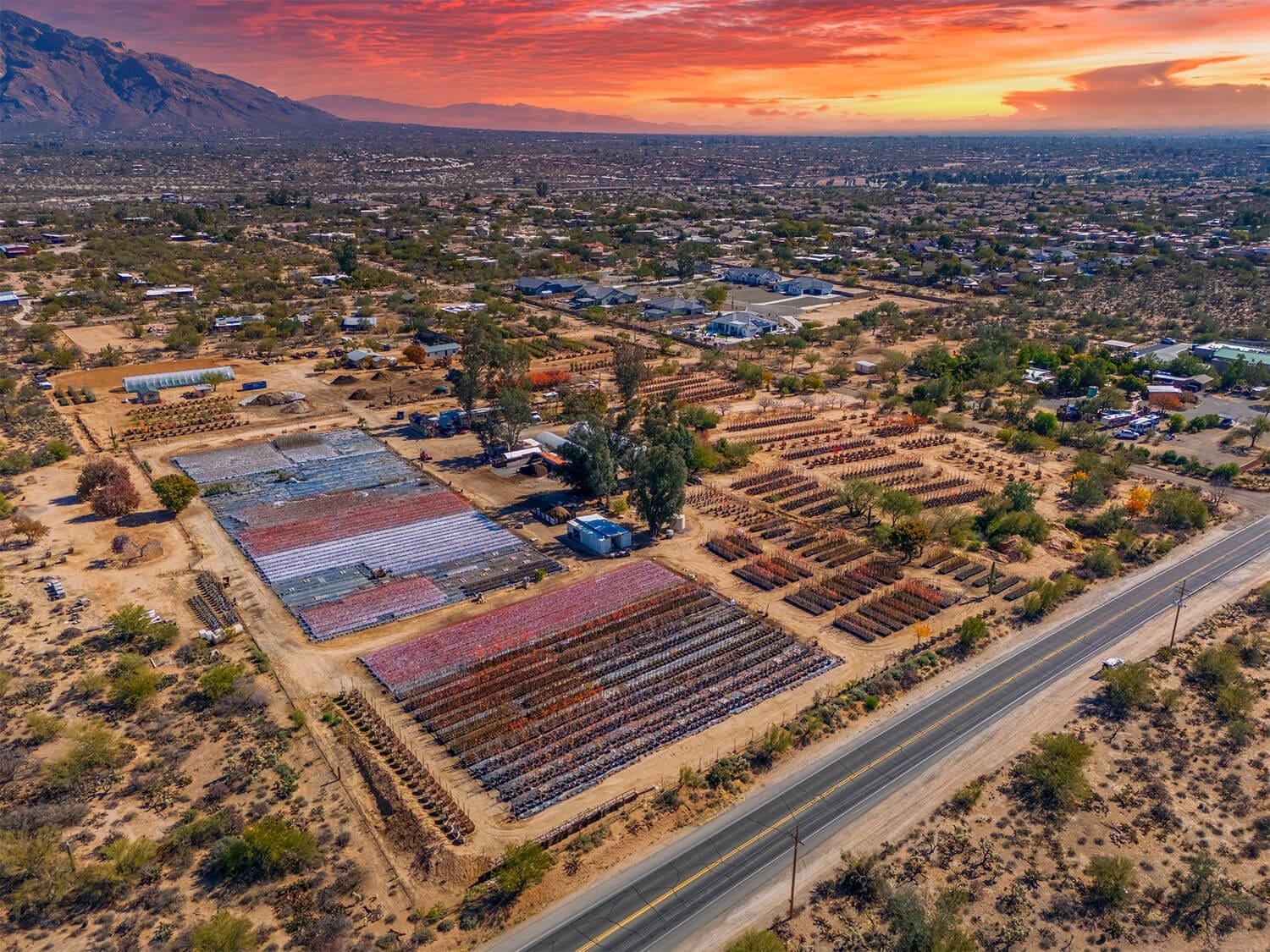
- Aerial Photography – Capture high-resolution images to showcase nursery stock, document tree farm inventory, and track growth cycles.
- Drone Footage – Create stunning drone videos to highlight seasonal displays, farm operations, and nursery layouts for marketing and documentation.
- FPV Fly-Throughs – Offer immersive first-person-view (FPV) drone tours of nurseries and tree farms, providing a unique way to showcase inventory and layout.
- Timelapse & Progress Photography – Schedule weekly or monthly drone flights to document plant growth, seasonal changes, and inventory shifts over time.
- Precision Field Mapping & Orthomosaic Imaging – Generate high-resolution, georeferenced maps to help tree farms with planting, inventory management, and operational planning.
- 3D Field Modeling – Create detailed 3D models of tree farms for better planning, growth assessment, and space management.
- Marketing & Promotional Videos – Use cinematic aerial footage to enhance sales and branding by showcasing nursery stock, seasonal selections, and farm operations.
- Inventory & Stock Monitoring – Maintain an accurate visual record of nursery inventory and tree farm stock with scheduled drone imagery, helping with organization and sales planning.
Who Can Benefit from Agricultural Drone Services?
Drone technology is a game-changer for a wide range of businesses in the agricultural industry. Whether you manage a nursery, operate a tree farm, or oversee large-scale agricultural production, aerial imaging and data collection can streamline operations, improve efficiency, and enhance marketing efforts. From tracking inventory to capturing stunning visuals for promotion, our drone services provide valuable insights and solutions tailored to the needs of various agricultural sectors.
Industries & Businesses That Benefit from Drone Services:
- Plant Nurseries – Monitor inventory, showcase seasonal stock, and create marketing visuals.
- Tree Farms – Track tree growth, assess inventory, and optimize planting strategies.
- Vineyards & Wineries – Document vineyard layouts, monitor crop health, and enhance branding with aerial footage.
- Orchards – Oversee tree growth, plan harvests, and create promotional content.
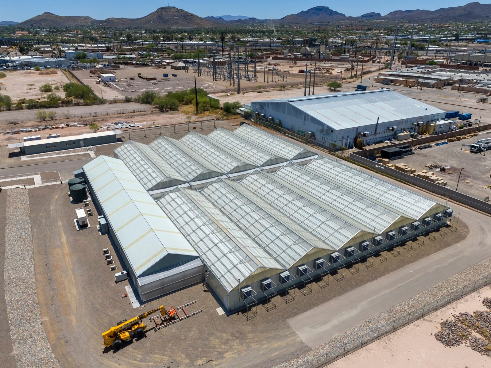
- Greenhouses & Indoor Farms – Capture overhead imagery for layout optimization and inventory tracking.
- Wholesale & Retail Garden Centers – Use aerial imagery and videos to display stock, attract customers, and manage supply.
- Landscaping & Wholesale Plant Suppliers – Showcase plant varieties, assess stock, and create promotional materials.
- Agricultural Cooperatives – Provide members with mapping, monitoring, and visual marketing resources.
- Forestry & Reforestation Projects – Track tree growth, assess replanting efforts, and monitor land use.
- Seed & Sod Farms – Document growth cycles, inventory changes, and optimize field usa
Take Flight Now
In today’s competitive agricultural market, having the right tools to manage, monitor, and market your business is essential. Whether you operate a plant nursery in Tucson, a tree farm near Phoenix, or a wholesale garden center anywhere in Arizona, our drone services provide the high-quality imagery, video, and mapping solutions you need. From inventory tracking to marketing visuals, our aerial photography and videography give your business a new perspective, helping you showcase your stock, plan operations, and make informed decisions.
At Southwest Drone Tech, we specialize in delivering professional drone services tailored to the agricultural industry. Whether you need high-resolution photos, dynamic marketing videos, FPV fly-throughs, or scheduled progress photography, we have the expertise to help. Contact us today to learn how our drone technology can enhance your farm, nursery, or agricultural business with precision, efficiency, and stunning visuals. Let’s take your business to new heights!