
Drone Inspections: A Safer Alternative to Traditional Methods
In the modern world, drones have emerged as a revolutionary tool for various industries, particularly in inspecting infrastructure. From bridges to rooftops, drone inspections offer numerous advantages over traditional methods. At Southwest Drone Tech, we specialize in providing high-quality drone inspection services that ensure safety and efficiency.
Advantages of Drone Inspections
Enhanced Safety: One of the most significant benefits of drone inspections is improved safety. Traditional inspection methods often require workers to climb ladders, scaffolding, or hang from ropes to access hard-to-reach areas, posing considerable risks of falls and injuries. Drones eliminate the need for personnel to be in hazardous situations, allowing inspections to be conducted from a safe distance. For insights on safety advantages, check the National Institute of Standards and Technology (NIST) report here.
Increased Efficiency: Drones can quickly cover large areas and capture detailed images from multiple angles. This rapid data collection allows for more comprehensive inspections in a fraction of the time it would take using traditional methods. Additionally, drones can access remote or hard-to-reach locations, streamlining the entire inspection process. For more on how drones can optimize workflow, see the DroneDeploy report here.
Cost-Effectiveness: While there may be initial costs associated with drone technology, the long-term savings can be substantial. Drone inspections reduce labor costs and minimize downtime, allowing for quicker project turnaround. The detailed data collected can also help identify issues before they escalate into costly repairs.
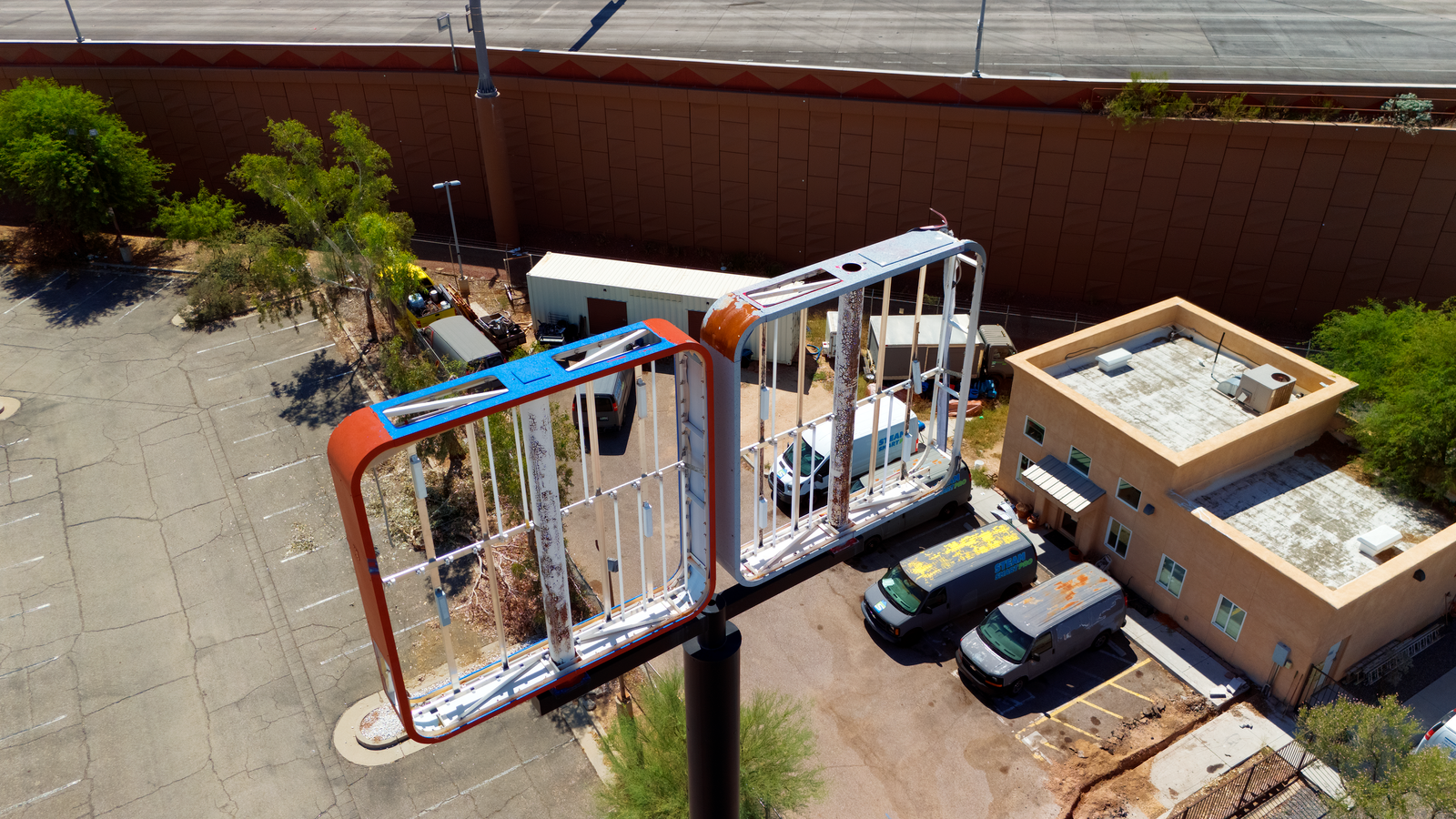
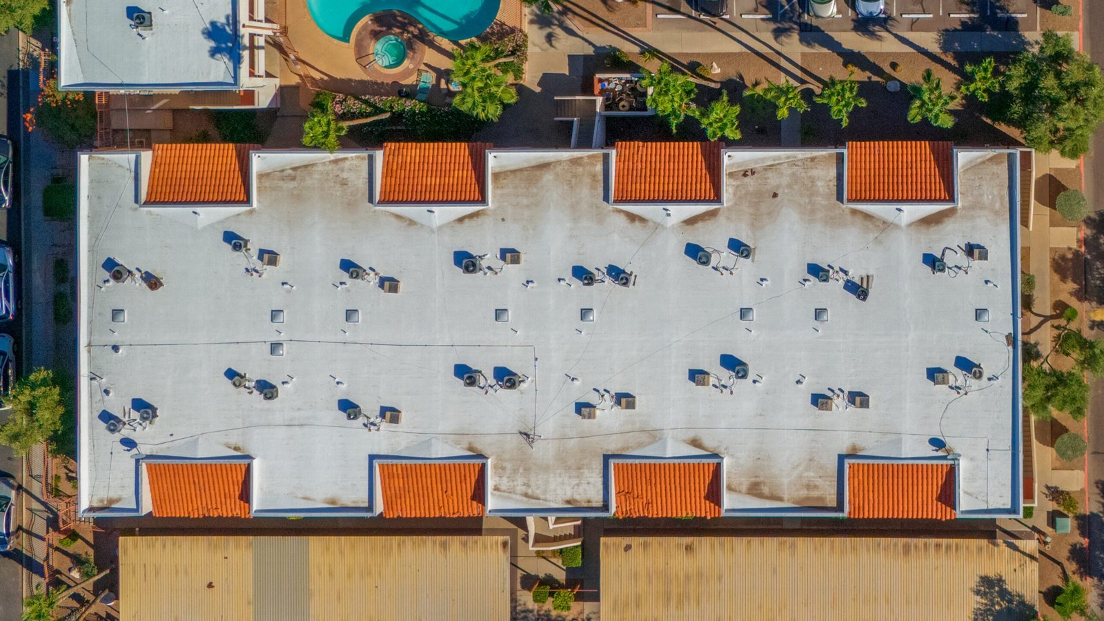
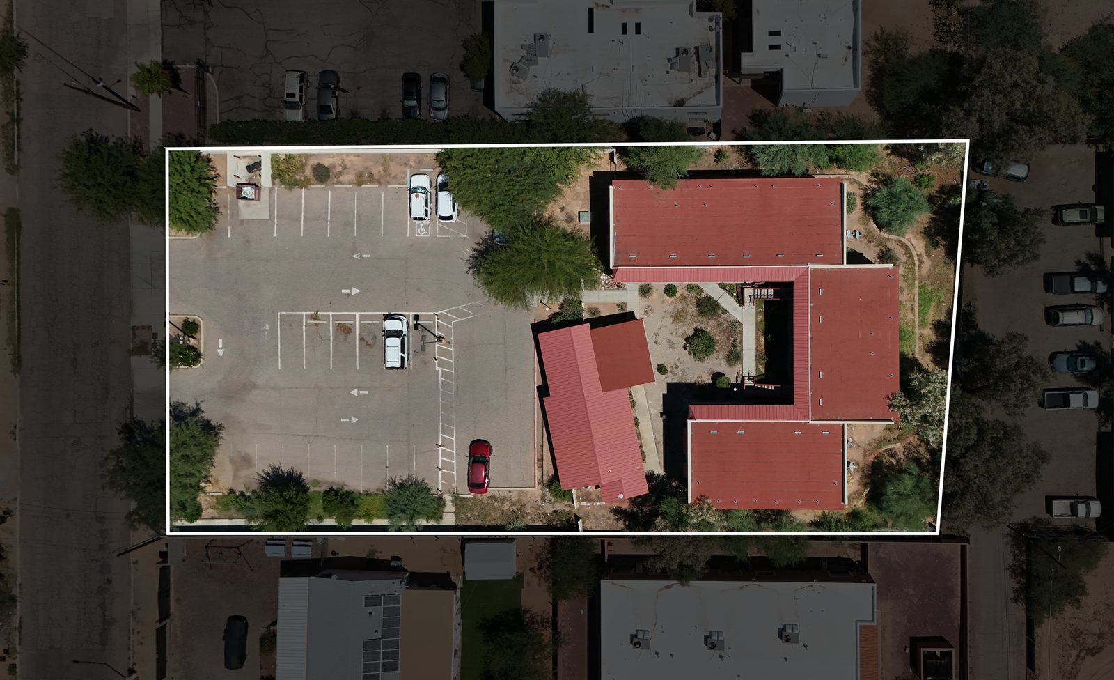
High-Resolution Imagery and Data Collection: Drones equipped with high-resolution cameras and sensors provide detailed visual data that traditional inspections may miss. This includes infrared imaging for identifying heat leaks in buildings or structural anomalies in bridges. With precise data, stakeholders can make informed decisions about maintenance and repairs, enhancing the overall quality of inspections.
The Impact of NIST Research on Drone Inspections
Studies from the National Institute of Standards and Technology (NIST) underscore the transformative role of drone technology in inspections. Their research reveals that drones enhance data accuracy, improve safety, and significantly reduce inspection times compared to traditional methods. By integrating drones into inspection practices, organizations can achieve a more efficient assessment process. For detailed insights, you can read the NIST report on drone usage in public safety agencies here . This study provides a comprehensive overview of the challenges and needs related to drone use in various sectors
Conclusion
Drone inspections are revolutionizing how we conduct infrastructure assessments in Tucson and Phoenix. This innovative approach enhances safety, increases efficiency, and provides detailed data collection, making drones a superior alternative to traditional inspection methods. With the ability to capture high-resolution images and gather precise measurements, drone technology transforms inspections across various industries, including construction, real estate, and public safety.
At Southwest Drone Tech, we are dedicated to delivering top-notch drone inspection services tailored to your specific needs. Our team of experienced drone pilots utilizes the latest technology to ensure accurate and reliable results for your infrastructure projects.
Are you ready to elevate your infrastructure inspections with cutting-edge drone technology? GET STARTED
For more information or to schedule a consultation, please contact us today! CONTACT US
Southwest Drone Tech LLC Disclaimer
While Southwest Drone Tech LLC excels in aerial data collection, it is important to note that we do not provide interpretations of survey-grade information. For projects where precise measurements are essential, you must consult a licensed land surveyor or survey engineer. We can collaborate with your surveyor to supply valuable data, but our services do not replace the need for a licensed land surveyor in any jurisdiction.
We do offer visual markers or outlines of property areas in our imagery as part of our packages; however, these are for general visual reference only and are not legally binding or survey-grade. This standard applies universally to all drone data collection services unless they employ a licensed surveyor. We do not provide formal boundary delineations for home lots (whether developed or undeveloped) intended for sale due to these limitations.