
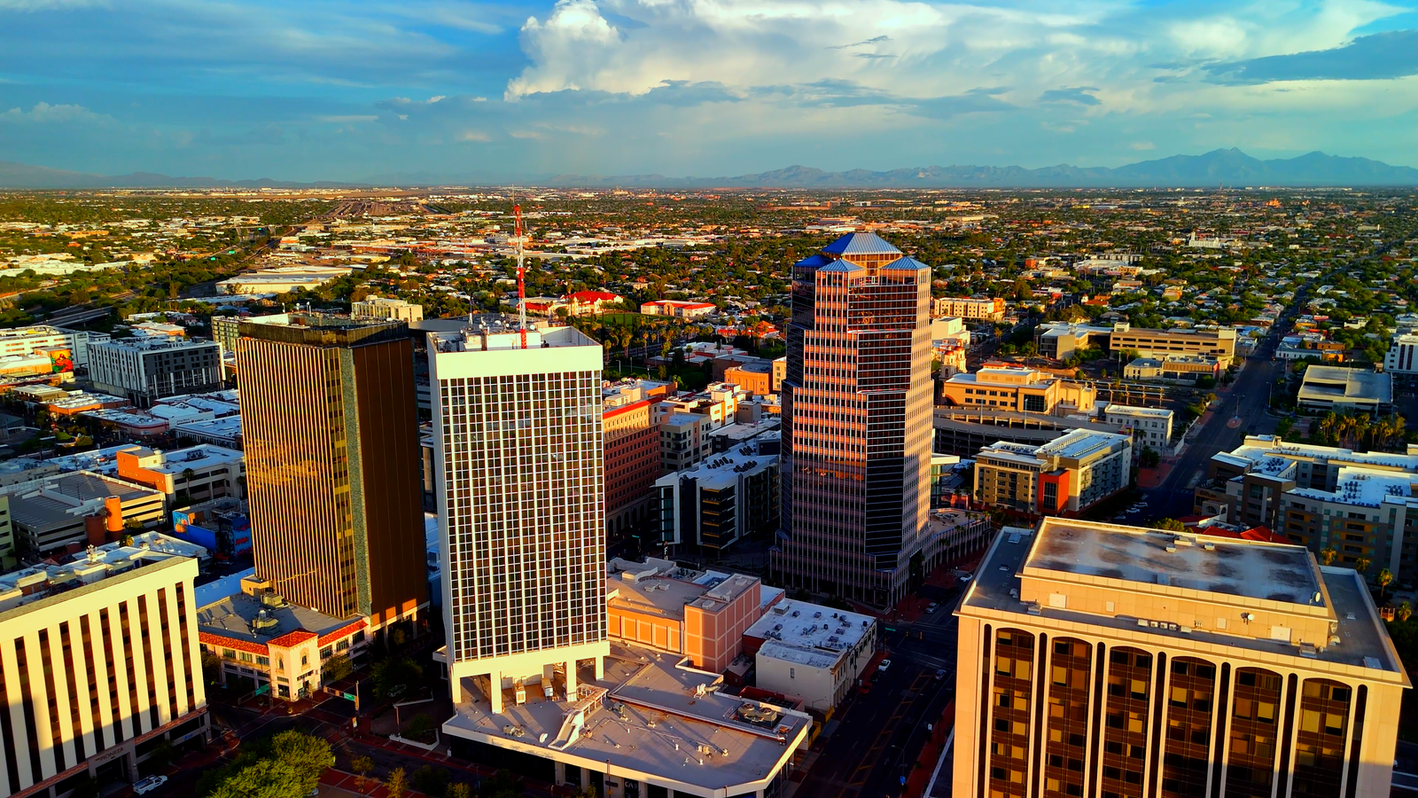
Drone Services for Industries Across Tucson, Phoenix, and Arizona
As industries across Tucson, Phoenix, and Arizona evolve, drone technology is becoming a game-changer in multiple sectors. From real estate to construction, agriculture, mining, and more, drone services provide an aerial perspective that enhances marketing, boosts operational efficiency, and improves safety. At Southwest Drone Tech, we offer a range of services, including aerial photography, videography, mapping, 3D modeling, time-lapse footage, and video editing, tailored to meet the unique needs of each industry.
Whether you’re looking to capture breathtaking aerial shots of a property, monitor a construction site, or map large tracts of land, our drone services offer the cutting-edge solutions that Arizona businesses need to stay competitive.
Real Estate: Boost Your Listings with Aerial Photography & Videography

Real estate marketing in Tucson and Phoenix has reached new heights with drone aerial photography and drone videography. Stunning visuals from unique perspectives give buyers a true sense of the property’s layout, size, and surroundings, making it easier for agents to sell homes, commercial spaces, and land.
Using drones, real estate professionals can create virtual tours, capture panoramic views of high-end homes, and showcase large commercial properties, ensuring their listings stand out in a competitive market. From aerial photos to 4K resolution video footage, our services are perfect for highlighting properties in all their glory. Learn more about our real estate drone services.
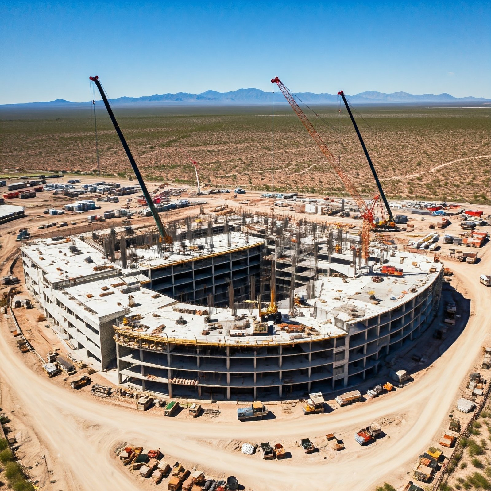
Construction: Monitor Progress & Ensure Site Safety
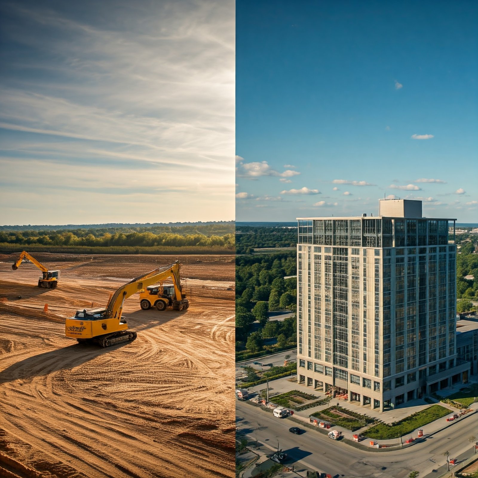
In the construction industry, drones offer a powerful way to monitor project progress, enhance safety, and streamline operations. Our drone services include aerial site surveys, time-lapse videos of construction progress, and mapping for accurate measurements and planning.
Drones also enable project managers to monitor large-scale construction projects from above, providing a clear view of worksite activity and overall progress. This visual documentation is invaluable for tracking project timelines, ensuring safety protocols are followed, and creating 3D models of the site. Discover how drones improve construction management.
Mapping & 3D Modeling: Precision for Surveying & Land Development
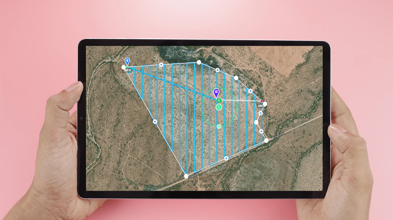
In industries that require precise data, such as land surveying, mining, civil engineering, and land development, our drones are equipped to capture high-quality aerial imagery and generate orthomosaic maps, 3D models, and topographical data.
Using drones for mapping in Tucson, Phoenix, and throughout Arizona significantly reduces the time and costs typically associated with traditional surveying methods. Whether you’re developing land in Tucson, overseeing a project in Phoenix, or managing a mining operation across Arizona, our drone-generated maps and models provide valuable insights for effective planning and decision-making.
Please note that while we offer detailed aerial imagery and data, we are not licensed surveyors. All surveying information must be verified by a licensed, partnered surveyor. Explore our mapping and 3D modeling services today!
Agriculture: Improve Crop Monitoring with Drone Mapping
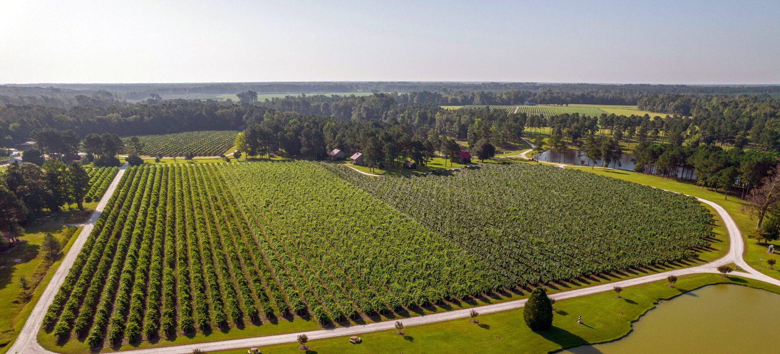
In the agriculture industry, drones are transforming the approach to precision farming techniques, empowering farmers to enhance crop monitoring, manage irrigation more effectively, and make informed, data-driven decisions. This innovative technology is particularly beneficial for agricultural producers in cities like Tucson and Phoenix, where the climate presents unique challenges for efficient crop management.
Our drones capture high-quality aerial imagery that allows farmers to assess crop health and identify potential issues across vast fields. This capability helps in detecting irrigation problems, evaluating crop density, and spotting signs of stress before they escalate into more significant challenges. By providing a bird’s-eye view of the land, drone technology enables farmers to gain valuable insights into their operations.
Farmers across Arizona can leverage drone technology to improve crop yields and minimize resource waste. By utilizing precise aerial data, they can optimize irrigation schedules, reduce water usage, and enhance overall productivity, leading to more sustainable farming practices. This approach not only boosts efficiency but also supports environmental stewardship, ensuring agricultural operations remain viable in the face of changing climatic conditions and resource limitations.
As the agricultural landscape continues to evolve, drones are becoming essential tools for farmers seeking to maximize efficiency and sustainability. Learn how drone technology is revolutionizing agriculture and discover the many ways it can benefit your farming practices today.
Tourism & Hospitality: Elevate Your Marketing with Stunning Aerial Footage
For the tourism and hospitality sectors, drones provide eye-catching visuals that help promote destinations and venues. Whether it’s capturing the serene desert landscapes of Tucson or the bustling cityscape of Phoenix, aerial photography can offer a unique perspective that draws potential visitors.
Resorts, hotels, golf courses, and outdoor attractions use drone videography to create immersive marketing content, from panoramic photos to stunning aerial tours that showcase their offerings. This helps attract guests by presenting the property in the most appealing light possible. See how drone footage can transform your tourism marketing.
Industries We Serve:
Real Estate: Drone photography and videography for listings, virtual tours, and marketing.
Construction: Site monitoring, progress documentation, 3D modeling, and mapping.
Agriculture: Crop monitoring, irrigation management, and land assessments.
Mining: Aerial surveys, volumetric measurements, and mapping.
Tourism & Hospitality: Marketing visuals for resorts, hotels, and tourist attractions.
Land Development: Mapping, surveying, and 3D models for development planning.
Roofing & Solar Inspections: Safe and efficient drone inspections for residential and commercial properties.
Event Marketing: Aerial footage for weddings, corporate events, and festivals.
Infrastructure & Utilities: Inspections of powerlines, bridges, and large infrastructure projects.
Environmental Monitoring: Aerial surveys for land conservation, habitat assessments, and environmental impact studies.
Insurance Assessments: Drone inspections for property damage assessments and claims documentation.
Telecommunications: Aerial inspections of cell towers and antenna structures for maintenance and compliance.
Sports & Recreation: Capturing aerial footage of sporting events, outdoor activities, and recreational facilities.
Why Choose Southwest Drone Tech?
At Southwest Drone Tech, we are dedicated to providing high-quality drone services that cater to a diverse array of industries across Tucson, Phoenix, and the greater Arizona area. Our commitment to excellence ensures that we meet the unique needs of each client, leveraging our expertise to deliver exceptional results every time.
Our team of skilled pilots is equipped with state-of-the-art drone technology, allowing us to undertake a variety of projects with precision and professionalism. We specialize in a range of services, including:
Aerial Photography: Capturing stunning aerial imagery for real estate listings, marketing campaigns, and special events. Our high-resolution photos showcase properties and landscapes from unique angles, helping our clients stand out in a competitive market.
Video Editing: Transforming raw aerial footage into captivating promotional videos. Our professional video editing services enhance the storytelling aspect of your content, providing polished and engaging visuals for your brand.
Mapping and 3D Modeling: Utilizing advanced drone technology for mapping and modeling applications. This service is invaluable for industries such as land development, construction, and agriculture, where accurate representations of terrain and structures are essential for planning and decision-making.
Construction Progress Monitoring: Offering detailed aerial documentation of construction sites. Our drone services allow project managers and stakeholders to track progress, assess safety, and ensure projects are on schedule, all while minimizing disruption to work sites.
Inspections: Providing aerial inspections for hard-to-reach areas such as rooftops, cell towers, and power lines. Our drones enable efficient and thorough inspections, reducing the need for scaffolding or ladders and improving safety for workers.
We proudly serve a variety of industries, including real estate, construction, agriculture, mining, and environmental monitoring. Our drone services are designed to enhance operational efficiency, reduce costs, and provide critical insights that drive informed decision-making.
With our extensive knowledge of the local landscape and regulations in Tucson, Phoenix, and across Arizona, we understand the specific challenges and opportunities present in each region. This localized expertise allows us to deliver customized solutions tailored to meet your unique requirements.
Southwest Drone Tech is your trusted partner for all things drone-related. We are committed to leveraging our technology and skills to help you achieve your goals, whether you’re looking to capture breathtaking visuals, streamline your operations, or gain a deeper understanding of your projects. Explore how our drone services can elevate your business today!