
Arizona Drone Services for Ranches & Cattle Operations
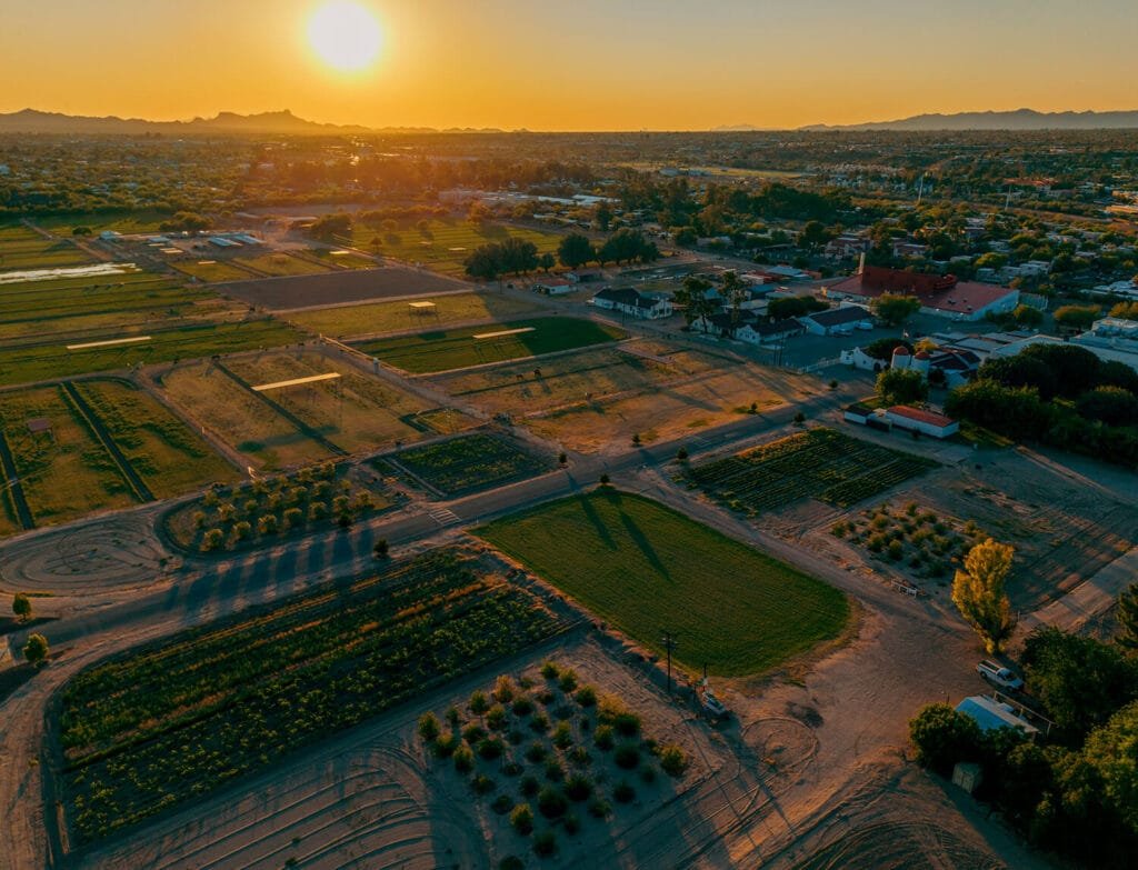
Across Arizona — from the rolling grasslands near Tucson to the wide-open ranges outside Phoenix — ranchers and landowners are using drone technology to market land, document improvements, and showcase active operations.
Southwest Drone Tech offers FAA-certified and insured drone services designed specifically for Arizona ranches, farms, and rural properties. Whether you’re preparing to list a property, highlight upgrades, or promote your cattle brand — we deliver high-resolution aerial photos, cinematic video, and practical mapping tailored to your needs.
High-Impact Aerial Photos & Video for Arizona Ranches
Drone visuals give ranchers a bird’s-eye view — helping you see, share, and promote your land like never before. Our aerial imagery helps capture:
- Full-property overviews in a single photo or flyover video
- Fencing, outbuildings, corrals, wells, tanks, and water features
- Grading work, new structures, ponds, and road improvements
- Before-and-after comparisons for restoration or upgrades
- Seasonal variations and grazing conditions
- Scenic beauty for listings, print marketing, or digital ads
For ranchers across Marana, Mesa, Chandler, Maricopa County, Pinal County, Cochise County, and throughout Arizona, these visuals provide powerful tools for property value, storytelling, and transparency.
Services We Offer
At Southwest Drone Tech, we deliver comprehensive drone solutions tailored for Arizona farmers, ranchers, and rural landowners:
Agricultural Imaging
Monitor crop health and irrigation with precise aerial photos.Livestock Overviews
Capture wide-angle views of cattle and herd movements.Real Estate Photos & Videos
Showcase ranch and farm properties with stunning visuals.FPV Flythroughs
Dynamic drone footage highlighting working ranches and equipment.Event Coverage
Film farm events, rodeos, and agricultural festivals professionally.Progress Documentation
Track fencing, grading, and land improvements over time.Seasonal Monitoring
Compare before-and-after aerial imagery across seasons.Aerial Mapping & 3D Modeling
Visualize land layout and infrastructure for better management.Water & Infrastructure Inspections
Inspect irrigation systems and rural property assets safely.
No matter the size of your operation or the scope of your project, Southwest Drone Tech provides expert drone services designed to meet the unique needs of Arizona’s agricultural community. Let us help you capture the full story of your land from above.
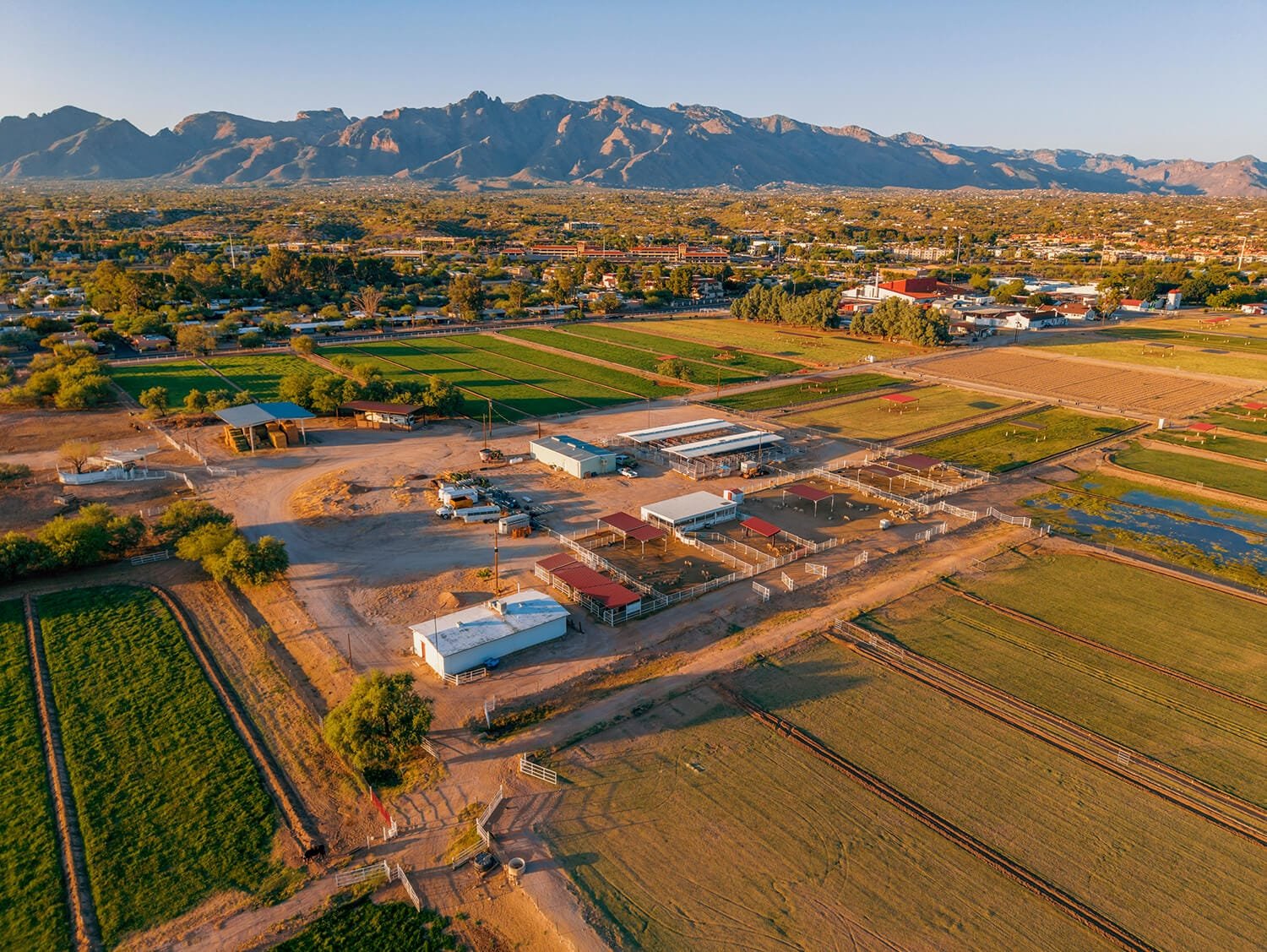
This Southwest Drone Tech video showcases the University of Arizona Campus Agricultural Center, a hub for agricultural research, education, and innovation. The center supports sustainable farming practices and advances in crop and livestock management.
FPV Flythroughs & Gimbal Footage: Bring Your Ranch to Life
Southwest Drone Tech combines traditional aerial views with FPV drone footage and stabilized handheld video for dynamic, ground-level storytelling. This hybrid approach is ideal for:
- Filming cattle drives, irrigation work, tractors, and working dogs
- Virtual tours for real estate buyers or out-of-state stakeholders
- Branded highlight reels for ranches, tourism, or events
- Social media content to grow visibility and trust
- Showing your operation in motion — with clarity and creativity
Perfect for direct-to-consumer beef marketing, real estate listings, or agritourism video, our FPV drone services let people experience the ranch up close — even from miles away.
Drone Mapping & 3D Modeling for Arizona Landowners
In addition to aerial photography and video, Southwest Drone Tech offers aerial mapping and 3D modeling—practical tools for effective land management. While not survey-grade, these services are highly useful for:
Visualizing acreage layout and terrain
Planning fencing, roads, and infrastructure
Documenting structures such as gates, barns, and corrals
Capturing water flow and drainage paths
Supporting leases, appraisals, and long-term estate planning
Enhance your property management with professional aerial mapping and 3D modeling.
Why Ranchers Work with Us
Landowners and agents across Arizona trust Southwest Drone Tech for expert aerial services that deliver clear value, including:
High-impact real estate listing visuals that capture buyer attention
Accurate documentation of grading, fencing, and new construction
Marketing content tailored for beef sales and agritourism promotions
Before-and-after imagery for conservation efforts and tax records
Legacy videos preserving family history and estate documentation
Remote sharing of property views with out-of-state family and partners
With deep knowledge of Arizona’s unique ranching challenges—from extreme heat and dust to remote access—we operate safely and professionally, minimizing disruption while delivering reliable results.
Case Study: Enhancing Farm Efficiency Using Drones
The USDA Natural Resources Conservation Service (NRCS) highlights how drones are transforming agriculture by enabling faster, safer, and more accurate data collection. This technology allows farmers to access difficult terrain and cover large areas quickly, improving efficiency and project timelines.
At Southwest Drone Tech, we align with these innovations by offering FAA-certified drone services tailored for Arizona’s agricultural landscape. Our high-resolution aerial imagery and mapping solutions empower farmers and ranchers to make informed decisions, optimize resources, and improve crop yields. By integrating advanced drone technology, we help streamline operations and support sustainable farming practices.
Read more about how drones are revolutionizing agriculture in the full USDA NRCS article here.
Frequently Asked Questions
Can you work on remote ranches and rural properties?
Southwest Drone Tech regularly travels to ranches and rural land throughout Southern and Central Arizona to deliver professional aerial real estate photography and video services.Do your drone photos and videos meet real estate marketing standards?
Our aerial content complies with MLS requirements and is optimized for platforms like Zillow and Realtor.com to ensure property listings look polished and professional.Do you provide before-and-after aerial visuals for land improvements?
We specialize in capturing before-and-after drone imagery and video to effectively document progress on ranch upgrades, conservation projects, and land restoration.What is your typical turnaround time for real estate drone projects?
Standard delivery times range from 48 to 72 hours, with rush editing options available for urgent property listings or time-sensitive events.
Showcase Your Land with Southwest Drone Tech
Whether preparing your property for sale, documenting land improvements, or preserving your ranch’s legacy, Southwest Drone Tech provides high-quality aerial visuals that capture every detail.
Serving ranchers, landowners, and real estate professionals across Tucson, Phoenix, and the greater Arizona region, our drone services help showcase your land from the best perspective.
Contact Southwest Drone Tech today to schedule your aerial drone shoot and enhance your property marketing.