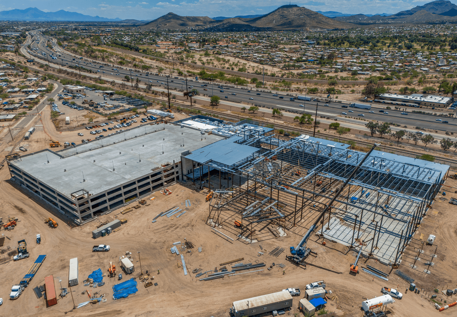
Construction Drone Services
The construction industry in Tucson and Arizona is rapidly evolving with the adoption of advanced technologies, and drone services are at the forefront of this transformation. At Southwest Drone Tech, we offer specialized drone solutions designed to streamline construction processes, improve project management, and enhance site safety. Whether you’re a developer, contractor, or project manager, our drone services provide valuable aerial insights that can help you stay ahead of the competition.
Why Use Drones in Construction?
Drone technology is revolutionizing construction projects in Tucson, Arizona, and beyond, offering unparalleled advantages that improve efficiency, safety, and decision-making. With real-time monitoring, precise measurements, and enhanced safety assessments, drones provide construction managers with critical insights that traditional methods can’t match. High-resolution aerial imagery and 3D mapping allow for detailed site analysis, helping teams identify potential issues early and make informed decisions.
At Southwest Drone Tech, we specialize in delivering accurate aerial progress reports, volumetric analysis, and site inspections to keep projects on track. Our drone services help construction teams efficiently monitor progress, optimize resource allocation, and inspect hard-to-reach areas without risking worker safety. By integrating drone technology, companies across Tucson and Arizona can reduce costly delays, improve communication with stakeholders, and ensure their projects stay on schedule and within budget.

Benefits of Our Construction Drone Services
- Progress Monitoring and Documentation: Capture high-resolution aerial images and videos to monitor construction progress and provide regular updates to clients and stakeholders.
- Site Surveys and Mapping: Conduct efficient and accurate topographic surveys, 3D mapping, and volumetric measurements without the need for traditional surveying methods.
- Improved Safety and Risk Management: Use aerial data to assess site safety, identify hazards, and ensure compliance with safety regulations, reducing on-site accidents.
- Marketing and Client Presentations: Enhance project presentations and marketing materials with stunning aerial visuals that showcase the project’s progress and final results.
- Cost and Time Efficiency: Drones provide a faster, safer, and more cost-effective alternative to traditional methods like scaffolding, cranes, and helicopters.
Construction Services We Offer
Aerial Progress Reports – Detailed progress monitoring with high-quality aerial photography and videography to keep stakeholders informed.
3D Mapping and Modeling – Advanced 3D models and digital elevation models (DEMs) to assist with planning, design, and project management.
Orthomosaic Mapping – High-resolution, georeferenced maps that provide a detailed overview of the site for surveying, planning, and monitoring purposes.
FPV Flythroughs – Immersive first-person-view (FPV) drone tours showcasing construction progress, providing dynamic perspectives for investors, stakeholders, and marketing materials.
Volumetric Analysis – Accurately measure stockpile volumes, cut and fill volumes, and other materials on-site, helping to optimize resource management.
Site Inspections and Monitoring – Conduct regular aerial inspections to monitor site activities, identify equipment usage, and track material deliveries, ensuring project timelines and budgets are adhered to.
Pre-Construction Site Surveys – Capture detailed aerial imagery and mapping data before construction begins to aid in planning, permitting, and environmental assessments.
Safety & Compliance Monitoring – Identify potential safety hazards, monitor worker compliance with safety regulations, and improve on-site security with frequent aerial assessments.
Marketing and Promotional Content – Capture high-quality aerial images and videos for use in promotional materials, investor presentations, and project showcase portfolios.
Before-and-After Comparisons – Capture consistent aerial imagery over time to visually document project evolution, helping clients and stakeholders see real-time progress.
Time-Lapse Construction Videos – Create engaging time-lapse videos using aerial footage to highlight key phases of the project from start to finish.
Site Overview and Marketing Footage – Capture cinematic aerial videos and photos to showcase the scale, location, and progress of the project for presentations, portfolios, and promotional use.
- Panorama Photographs – Capture wide-angle panoramic shots that provide a sweeping, detailed view of the construction site, ideal for presentations, marketing materials, and site overviews.

Get Started Today
Maximize efficiency and accuracy on your construction projects with Southwest Drone Tech’s professional drone services in Tucson, Phoenix, and throughout Arizona. From aerial progress reports and 3D mapping to orthomosaic mapping and site inspections, our construction drone services provide high-resolution imagery and actionable data to enhance decision-making. Whether you need volumetric analysis, FPV construction flythroughs, or before-and-after comparisons, our drone photography and videography solutions help construction managers streamline workflows, optimize resources, and stay on schedule. Contact us today to learn how our drone technology can support your next project.
Captivate Your Audience – Contact Us Today!
Southwest Drone Tech LLC Disclaimer
While Southwest Drone Tech LLC excels in aerial data collection, it is important to note that we do not provide interpretations of survey-grade information. For projects where precise measurements are essential, you must consult a licensed land surveyor or survey engineer. We can collaborate with your surveyor to supply valuable data, but our services do not replace the need for a licensed land surveyor in any jurisdiction.
We do offer visual markers or outlines of property areas in our imagery as part of our packages; however, these are for general visual reference only and are not legally binding or survey-grade. This standard applies universally to all drone data collection services unless they employ a licensed surveyor. We do not provide formal boundary delineations for home lots (whether developed or undeveloped) intended for sale due to these limitations.
