
Documenting Progress: Aerial Site Monitoring for Arizona Construction
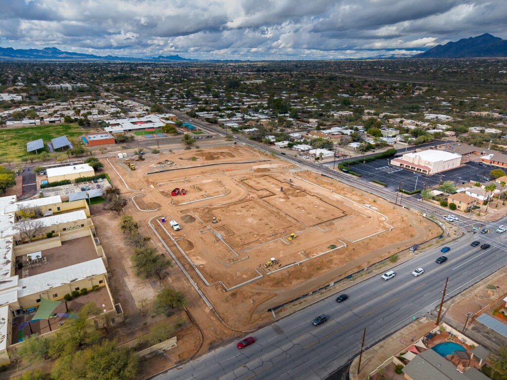
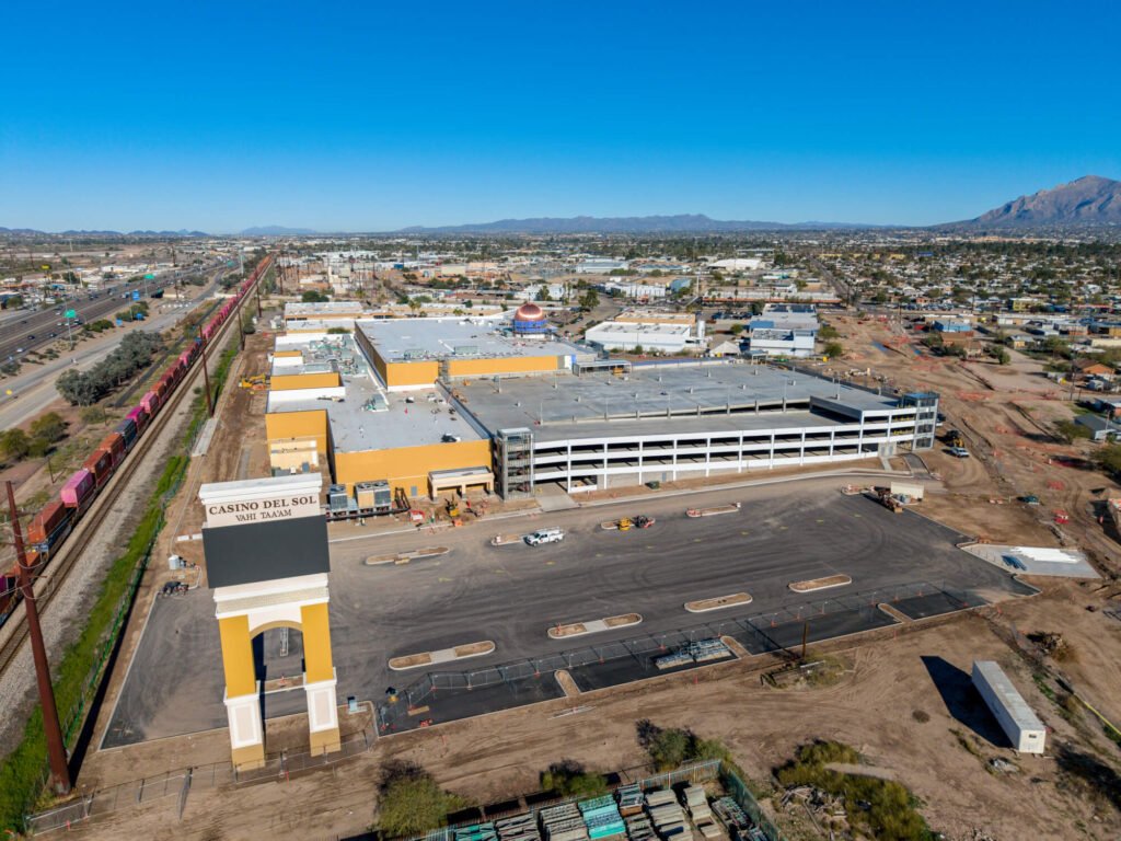
In the fast-paced world of Arizona development, staying on schedule is everything. From new commercial hubs in Chandler to residential expansions in Tucson, project managers need reliable, high-fidelity data to keep moving parts in sync. Our Arizona construction drone site monitoring provides a consistent, high-angle record of progress that ground-level inspections simply cannot match.
The Value of Monthly Bird’s-Eye Updates
For project managers and stakeholders, seeing is believing—and documenting. Monthly aerial updates offer a comprehensive visual history of a site’s evolution, ensuring that everyone from the foreman to the investors is on the same page. In the sprawling construction landscapes of Phoenix and Marana, these updates are essential for maintaining oversight across massive footprints.
- Stakeholder Transparency: Provide investors and remote partners with high-resolution visual proof of milestones reached.
- Enhanced Site Logistics: Use wide-angle perspectives to plan equipment placement, material storage, and traffic flow across the job site.
- Accurate Timeline Documentation: Create a chronological record of progress to resolve disputes, verify subcontractor work, and assist in future planning. View Construction Services
A Professional Standard for Site Documentation
We deliver more than just photos; we provide a technical record designed for the corporate aesthetic of modern construction firms. Our process ensures that every update is consistent in quality and perspective, making it easy to compare month-over-month growth.
- High-Resolution Progress Stills: Crisp, clear imagery perfect for inclusion in monthly reports and stakeholder presentations.
- Cinematic Progress Films: Short, edited video recaps that showcase the most significant changes on-site with professional color science.
- Consistent Flight Paths: We utilize precision techniques to ensure the same angles are captured every month, providing a true comparison of progress.
- Post-Production Integrity: Every asset is processed with a focus on technical integrity, ensuring a clean, professional output ready for any boardroom.
Solving Communication Gaps in Large-Scale Projects
The primary challenge of large-scale Arizona construction is the communication gap between the field and the office. Aerial monitoring bridges this by:
- Reducing Site Visits: Allow stakeholders to inspect progress virtually, saving time and travel costs.
- Identifying Risks Early: Spot potential drainage issues, safety concerns, or logistical bottlenecks before they become costly delays.
- Marketing Your Portfolio: Use the final time-lapse and progress footage to showcase your firm’s capabilities to future clients.
Why Choose Us for Your Arizona Construction Monitoring?
- Certified and Insured: Fully FAA-compliant operations with a focus on job site safety and professional conduct.
- Local Experience: Deep familiarity with the construction corridors of Tucson, Phoenix, and Chandler.
- High-Fidelity Output: We prioritize technical integrity, ensuring your project is documented with the highest possible visual quality.
- Reliable Scheduling: We work around your project milestones to ensure we capture the site at the most critical moments.
Frequently Asked Questions
Q: Can you provide a time-lapse of the entire project?
A: Yes. By capturing consistent angles over several months, we can produce a professional time-lapse video that showcases the complete build from dirt to finish.
Q: How do you handle safety on active construction sites?
A: We are fully FAA-certified and follow strict safety protocols, including coordinating with site supervisors to ensure our operations never interfere with active work.
Q: Are the images clear enough to identify specific materials or equipment?
A: Absolutely. We provide high-resolution, 4K+ imagery that allows for significant zooming and detailed inspection of site assets.
Q: How quickly are the monthly reports delivered?
A: We typically deliver processed photos and videos within 1–3 business days of the flight, ensuring you have the data ready for your next meeting.
Keep Your Project on the Map
Don’t leave your project’s documentation to chance or low-quality snapshots. Give your stakeholders the clarity and confidence they deserve with professional aerial monitoring that captures every milestone of your Arizona build.
Contact us today to set up a recurring site monitoring schedule and experience the high-angle advantage for your next construction project.
Contact Southwest Drone Tech LLC
Phone: (520) 333-5839
Website: https://southwestdronetech.com/
Instagram: https://www.instagram.com/southwestdronetech/
Email: info@southwestdronetech.com