
Drone Marketing for Wineries, Vineyards, and Event Venues
Your winery, vineyard, or event venue in Tucson or Phoenix, Arizona, is more than just a location—it’s an experience. Using drones, Southwest Drone Tech helps capture this experience with breathtaking aerial views and high-quality ground-level visuals. Our services enhance the charm of your space and provide essential data to streamline operations and create unforgettable memories for your guests.
Southwest Drone Tech: Your Aerial and Ground Production Partner
Southwest Drone Tech specializes in comprehensive visual solutions for wineries, vineyards, and event venues across Tucson and Phoenix. Our team not only delivers stunning aerial footage but also uses advanced cameras for professional on-the-ground photography and videography.
Unleash the Power of Aerial and Ground Imagery
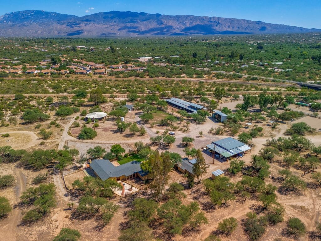
- Showcase the Beauty of Your Space
Highlight the unique appeal of your winery, vineyard, or wedding venue with stunning aerial photos and videos. From lush vineyards in Tucson to elegant wedding venues in Phoenix, our visuals tell your story from a fresh perspective. - Create Immersive Virtual Tours
Let potential visitors explore your Tucson vineyard or Phoenix event venue without leaving their homes. Our virtual tours combine aerial views with detailed ground-level footage to inspire excitement and anticipation. - Capture Unforgettable Events
Whether it’s a wedding at your venue or a festival at your winery, Southwest Drone Tech provides aerial and ground-level coverage to showcase the event’s magic. Shareable content helps build your brand and attracts new visitors.
Optimize Winery, Vineyard, and Event Operations
- Precision Management for Vineyards
Enhance vineyard operations with drone-generated maps that guide planting, irrigation, and crop management. This data empowers wineries in Tucson and Phoenix to maximize yield and quality. - Efficient Equipment Oversight
Use aerial imagery to monitor winery machinery, vineyard tools, and event rental equipment, ensuring everything is in top shape for your guests. - Streamline Event Layouts
Plan weddings and events with precision. Drones provide a bird’s-eye view to optimize layouts, improve guest flow, and ensure a seamless experience at your Phoenix venue or Tucson vineyard.
Who Can Benefit from Drone Mapping
Drone mapping is a versatile tool that provides valuable insights to a wide range of clients across various industries. Whether you’re looking to monitor land, plan projects, or manage resources more effectively, drone mapping can deliver the accurate, high-quality data you need. Here are some of the client niches that can benefit from these services:
- Ranch owners
- Farmers
- Homesteaders
- Wineries and vineyards
- Wedding venues
- Event planners
- Commercial real estate developers
- Property management companies
- Construction companies
- Land surveyors (for supplemental aerial data)
- Environmental consultants
- Utility companies
- Event venues
- Mining and resource management firms
- Landscape architects
- Insurance adjusters
- Government agencies (e.g., for land use or zoning assessments)
Why Choose Southwest Drone Tech?
Drones offer unparalleled versatility for wineries, vineyards, and event venues, but Southwest Drone Tech takes it a step further. Based in Arizona, we proudly serve both Tucson and Phoenix with a comprehensive range of services. From stunning aerial imagery to professional ground-level video and photo production, we provide the tools you need to showcase your space and optimize your operations.
Our combination of aerial and ground-based visuals captures the essence of your winery, vineyard, or event venue, helping you stand out in a competitive market. Whether you’re looking to attract visitors, promote events, or streamline operations, our expertise ensures exceptional results every time.
Take your Tucson or Phoenix business to new heights with Southwest Drone Tech. Contact us today to create unforgettable experiences and optimize your operations with our cutting-edge drone and visual production services.
Southwest Drone Tech LLC Disclaimer
While Southwest Drone Tech LLC excels in aerial data collection, it is important to note that we do not provide interpretations of survey-grade information. For projects where precise measurements are essential, you must consult a licensed land surveyor or survey engineer. We can collaborate with your surveyor to supply valuable data, but our services do not replace the need for a licensed land surveyor in any jurisdiction.
We do offer visual markers or outlines of property areas in our imagery as part of our packages; however, these are for general visual reference only and are not legally binding or survey-grade. This standard applies universally to all drone data collection services unless they employ a licensed surveyor. We do not provide formal boundary delineations for home lots (whether developed or undeveloped) intended for sale due to these limitations.