
Professional Drone Mapping Services in Arizona – Southwest Drone Tech
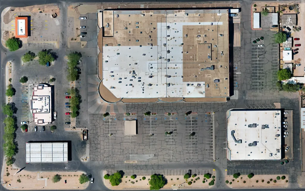
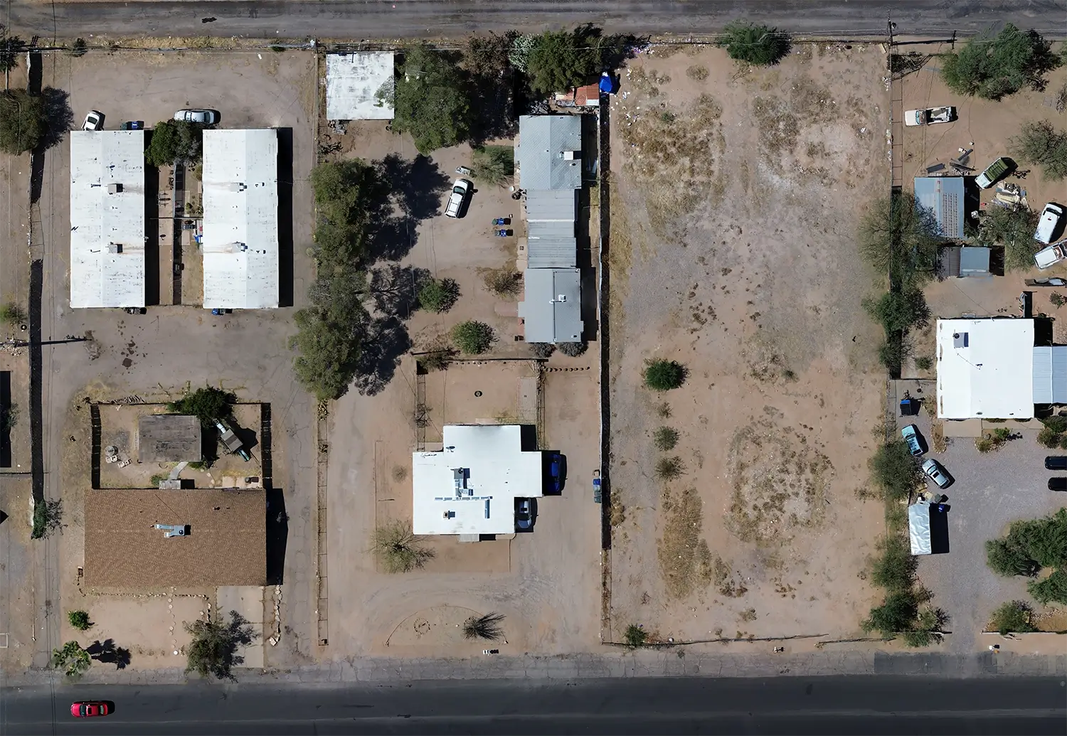
Drone mapping services are revolutionizing how Arizona industries operate—from construction sites in Phoenix to farms outside Tucson. Using advanced drone technology, businesses can now access precise aerial data, 3D models, and survey-grade maps faster and more affordably than ever before.
Whether you need topographic data for a construction project, crop analysis for agriculture, or a full orthomosaic map of your development site, Southwest Drone Tech delivers the accuracy and efficiency modern businesses demand.
Benefits of Drone Mapping Services
Drone mapping is helping Arizona industries stay competitive by providing rich visual data and spatial analysis. Some top use cases include:
-
High-Resolution Data: Capture sharp aerial imagery used to create precise maps, 3D models, and terrain analyses.
-
Time Efficiency: Cover large areas quickly—perfect for expansive job sites or large properties.
-
Cost-Effective Solutions: Eliminate the cost of ground crews, expensive equipment, and prolonged survey timelines.
-
Real-Time Results: Get updated, actionable data fast to make confident decisions.
-
Versatile Applications: Ideal for construction, real estate, agriculture, mining, and environmental monitoring.
Industries Using Drone Mapping in Arizona
Drone mapping is helping Arizona industries stay competitive by providing rich visual data and spatial analysis. Some top use cases include:
-
Construction Companies: Need site planning, topographic data, and progress tracking.
-
Farmers & Agricultural Managers: Use aerial data for crop planning, irrigation management, and yield analysis.
-
Real Estate Developers: Market large properties with high-quality aerial visuals and accurate parcel data.
-
Land Surveyors: Access elevation data quickly for boundary, zoning, or development analysis.
-
Municipalities & Utilities: Monitor infrastructure, zoning compliance, and environmental changes efficiently.
Our Specialized Mapping Services
We offer a full suite of aerial services designed to enhance every phase of your project:
-
3D Modeling: Generate accurate, scalable 3D models for site analysis, design, and visualization.
-
Topographic Mapping: Collect elevation and terrain data for grading, drainage, and engineering plans.
-
Orthomosaic Mapping: Stitch high-resolution aerial photos into detailed, geo-referenced maps.
-
Land Surveying: Use drone-captured data for fast, accurate land development insights.
-
Agricultural Mapping: Identify plant health, optimize irrigation, and monitor yield performance.
-
Construction Progress Monitoring: Visually track project stages and document key milestones from above.
-
Volumetric Measurements: Calculate material volumes (stockpiles, cuts/fills) with precision.
-
Environmental Monitoring: Track erosion, vegetation health, or habitat changes over time.
-
GIS Integration: Seamlessly incorporate drone data into your existing Geographic Information Systems.
Why Choose Southwest Drone Tech?
At Southwest Drone Tech, we specialize in delivering high-resolution aerial data to businesses across Arizona, including Tucson and Phoenix. Our FAA-certified drone pilots use industry-leading software and hardware to ensure every model, map, or survey we deliver meets the highest accuracy standards.
We’re more than drone operators—we’re data partners. We work closely with you to tailor every flight and output to your project’s needs, whether you need detailed terrain modeling, real estate visuals, or survey-grade data.
Frequently Asked Questions
What industries benefit most from drone mapping in Arizona?
Construction, agriculture, real estate, mining, and land development all benefit significantly from the fast, accurate data drone mapping provides.
How accurate is drone surveying compared to traditional methods?
When properly flown and processed, drone surveys can reach sub-inch accuracy, depending on conditions and ground control points.
Do you service clients outside of Tucson and Phoenix?
Yes! We provide drone mapping services throughout Arizona and can accommodate projects in rural and remote areas.
Get Started with Expert Drone Mapping
Ready to streamline your next project with fast, reliable aerial data?
Contact Southwest Drone Tech today for a free consultation and see how our drone mapping services can save you time, reduce costs, and increase precision.
📞 Call us or visit southwestdronetech.com/contact to get started.
Contact us today to schedule your aerial photography drone services in Tucson.
Disclaimer:
Southwest Drone Tech is not a licensed surveyor and does not provide professional land surveying or legal property boundary services. Our drone mapping services collect high-quality aerial data and imagery but do not interpret, certify, or guarantee survey accuracy. For official surveying, boundary determinations, or legal use, please consult a licensed surveyor.