Drone Mapping
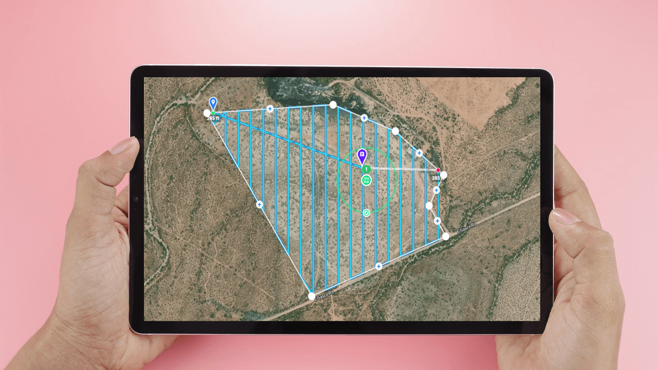
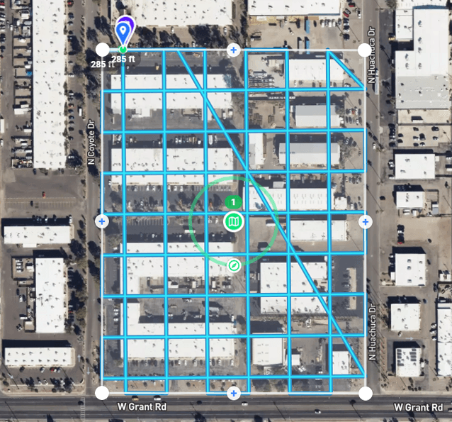
At Southwest Drone Tech, our mapping services utilize advanced drone technology to create precise, high-resolution maps for a variety of applications. Our aerial mapping solutions are ideal for industries such as construction, real estate, agriculture, and urban planning.
Our state-of-the-art drones capture detailed aerial imagery, providing valuable insights and enhancing your project planning and analysis.
Our Comprehensive Approach to UAV Mapping
An Unmanned Aerial Vehicle (UAV) is a versatile drone equipped with advanced sensors and cameras, used to capture detailed aerial imagery and data from above.
At Southwest Drone Tech, we utilize cutting-edge UAV technology to deliver high-precision mapping services across Tucson, Phoenix, and Arizona. Our UAVs capture comprehensive aerial data, providing detailed and accurate maps tailored to your specific needs.
We offer complete mapping solutions, including data processing and 3D modeling, to ensure that your visual content is both informative and actionable. Whether for real estate, construction, agriculture, or urban planning, our UAV mapping services provide a unique perspective and valuable insights to support your projects.

Aerial Mapping Services:
- Real Estate Mapping: Create detailed property maps showcasing boundaries, features, and surroundings to enhance listings and planning.
- Construction Site Mapping: Document progress with precise site maps capturing changes throughout the project lifecycle.
- Agricultural Mapping: Analyze crop health and field conditions with accurate aerial maps for better farming decisions.
- Urban Planning and Development: Generate maps for planning, development, and assessments, providing valuable data for city projects.
- Surveying and GIS Data Collection: Obtain accurate geospatial data for detailed analysis and project planning in GIS systems.
- Environmental Monitoring: Track changes in natural landscapes and monitor conditions with high-resolution aerial maps.

Southwest Drone Tech LLC provides detailed aerial data but does not offer survey-grade measurements. For precise measurements, consult a licensed land surveyor. Our visual markers in imagery are for general reference and not legally binding.
Why Choose Southwest Drone Tech for Aerial Mapping?
High-Resolution, Detailed Maps: We use advanced drones with high-resolution cameras to capture accurate and detailed aerial maps.
Skilled Pilots and Technicians: Our team combines expert drone piloting with advanced mapping techniques to deliver precise and dependable results.
Custom-Tailored Mapping Solutions: We offer flexible packages and tailored mapping services to meet the specific needs of various industries and projects.
Data Processing and Analysis: We provide thorough data processing and analysis to ensure your maps are informative and actionable.
Click on the video player to start playback. Select the gear icon (⚙️) located at the bottom-right corner of the video. Choose the highest available resolution setting from the list. *Volume is muted by default*
FAQ
What types of aerial mapping services are available?
We offer a range of aerial mapping services, including property mapping, construction site documentation, agricultural analysis, and urban planning. Our services deliver detailed, high-resolution maps tailored to your project needs.
How can drone mapping benefit my business?
Drone mapping provides accurate and detailed aerial views that enhance project planning, decision-making, and monitoring, helping you visualize data and track progress efficiently.
In what ways can aerial mapping improve my real estate listings?
Aerial mapping offers detailed property maps that highlight boundaries, features, and surroundings, enhancing property presentations and helping potential buyers better understand the property.
Do you provide aerial mapping services for construction projects?
Yes, we specialize in creating detailed construction site maps that capture progress and changes over time, providing valuable insights for project management and reporting.
Can drone mapping be used for agricultural purposes?
Absolutely. Aerial mapping helps analyze crop health, monitor field conditions, and optimize irrigation practices with detailed and accurate maps.
Are there any restrictions on where you can fly drones for mapping?
Drone operations are subject to FAA regulations and local rules. We ensure compliance with all legal requirements in Tucson and Phoenix, handling necessary permits for safe and lawful mapping.
What file formats do you provide for mapping deliverables?
We deliver mapping data in various formats such as JPEG, PNG, TIFF, and GIS-compatible files, chosen based on the intended use and integration needs.
What makes your aerial mapping services stand out in Arizona?
Southwest Drone Tech combines advanced technology with local expertise in Tucson, Phoenix, and all throghout Arizona to provide precise and high-quality mapping solutions tailored to your specific requirements.
How do you ensure the quality of the final mapping content?
We utilize advanced drones with high-resolution cameras and GPS systems to capture precise data, embedding metadata in each image. This technology allows us to verify the accuracy and detail of the final maps, ensuring they are both reliable and actionable.
How do I schedule an aerial mapping session?
To schedule a mapping session, contact us with details about your project—whether it’s for real estate, construction, or agriculture. We’ll arrange a convenient time to capture and process the necessary aerial data.
Captivate Your Audience – Contact Us Today!
Southwest Drone Tech LLC Disclaimer
While Southwest Drone Tech LLC excels in aerial data collection, it is important to note that we do not provide interpretations of survey-grade information. For projects where precise measurements are essential, you must consult a licensed land surveyor or survey engineer. We can collaborate with your surveyor to supply valuable data, but our services do not replace the need for a licensed land surveyor in any jurisdiction.
We do offer visual markers or outlines of property areas in our imagery as part of our packages; however, these are for general visual reference only and are not legally binding or survey-grade. This standard applies universally to all drone data collection services unless they employ a licensed surveyor. We do not provide formal boundary delineations for home lots (whether developed or undeveloped) intended for sale due to these limitations.
