
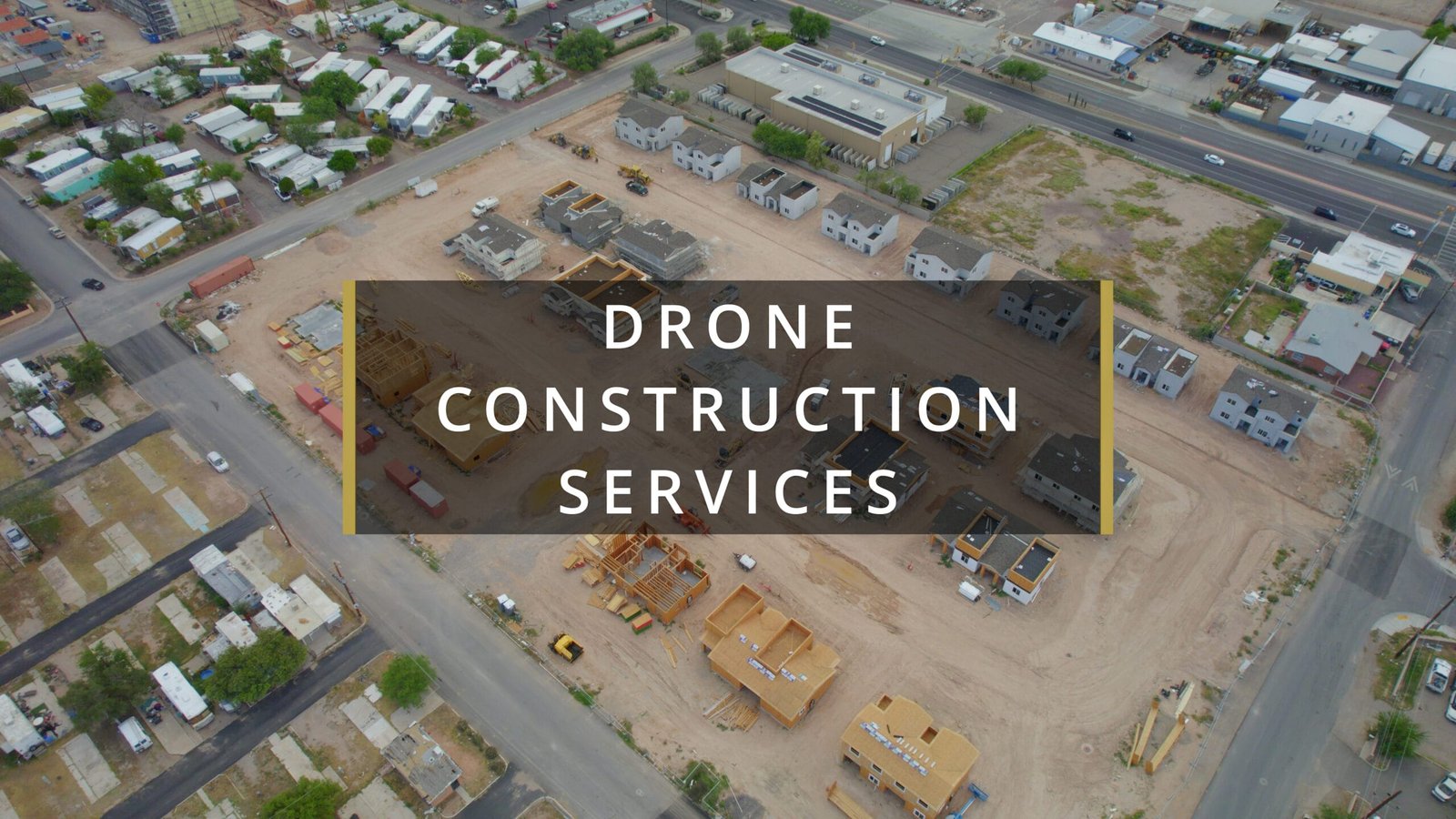
Drone Services for Construction Companies in Tucson and Arizona
In the fast-paced world of construction, staying ahead of project timelines, documenting progress, and ensuring accurate site surveys is crucial. Drone services offer construction companies in Tucson, Phoenix, and across Arizona an innovative and efficient way to enhance project management, safety, and client presentations. Whether you’re looking to capture high-quality photos, create detailed 3D maps, or show before-and-after comparisons, drones provide a versatile toolset that can significantly improve the quality of your construction projects.
Drone Photography for Detailed Site Documentation
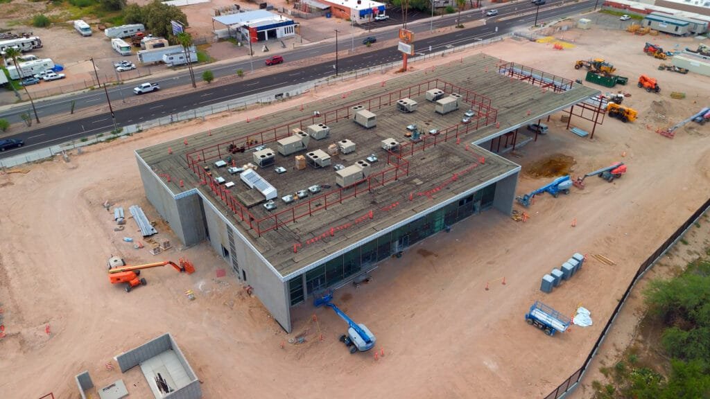
Aerial drone photography provides construction companies with an elevated perspective that ground-based cameras simply cannot match. Whether you’re looking to showcase the full scope of your project site or capture specific details, drones offer high-resolution images that give a clear view of your progress. Drone photography can be used for project documentation, marketing, and client presentations, offering a fresh and engaging way to highlight your work.
How it helps:
- High-quality, detailed images of construction sites
- Clear documentation of site progress for internal records or client updates
- Aerial shots that provide a comprehensive view of the construction site
Drone Video for Real-Time Project Updates
Drone video offers a dynamic way to capture the movement and progression of construction projects. Time-lapse and real-time video footage can be used to document everything from groundbreaking to final touches. With a drone’s ability to move seamlessly through the site, video footage provides a comprehensive, cinematic look at construction progress. This footage can be used for internal reports, promotional videos, or as an engaging way to keep clients informed.
How it helps:
- Real-time video updates that show day-to-day construction activity
- Cinematic footage for promotional content or client showcases
- Time-lapse videos that condense long projects into visually compelling sequences
Drone Timelapse for Capturing Long-Term Progress
Drone timelapse footage is a powerful way to visualize a construction project’s progress over time. This technique allows construction companies to capture months of work in just a few minutes of footage, providing a compelling visual narrative for presentations, reports, or marketing materials. Timelapse videos also help highlight the efficiency of your team and showcase your construction timeline in a visually appealing way.
How it helps:
- Visually stunning videos showing the entire project’s evolution
- Engaging marketing material that attracts clients or investors
- Demonstrates the speed and efficiency of your construction work
Drone Mapping for Accurate Site Surveys
Southwest Drone Tech LLC Disclaimer
Southwest Drone Tech LLC specializes in aerial data collection but does not interpret survey-grade information. For precise measurements, consult a licensed land surveyor or engineer. We can work alongside your surveyor to provide useful data, but our services are not a replacement for licensed surveyor work.
Our imagery may include visual markers or property outlines for reference, but they are not legally binding or survey-grade. We do not offer formal boundary delineations for property lots intended for sale.
Drone mapping services, including photogrammetry and 3D modeling, are game changers for construction projects. Using high-resolution aerial imagery, drones can generate precise topographic maps, models, and volumetric measurements of construction sites. This level of detail is invaluable for surveying, planning, and measuring material volumes or earthworks. Drone mapping provides construction companies with a fast, cost-effective way to survey large areas without the need for expensive equipment or time-consuming manual surveys.
How it helps:
- Accurate topographic maps for project planning and site analysis
- Volumetric measurements for material estimation or excavation projects
- Fast, efficient surveys that save both time and money
Orthomosaic Mapping for Precise Accuracy
Orthomosaic maps are generated from high-resolution drone images and are essential for projects requiring precise, scalable maps. These maps can be used to analyze site conditions, monitor construction progress, or assist with design and planning. The resulting high-level accuracy of an orthomosaic map can be invaluable for various stages of construction, from site preparation to final inspection.
How it helps:
- Extremely accurate, high-resolution maps for planning and analysis
- Useful for monitoring construction progress and comparing different stages of the project
- Detailed maps that help avoid mistakes or delays in the project
Before-and-After Comparisons for Visual Proof of Progress
One of the most powerful uses of drone services is showing before-and-after comparisons. Drones allow you to capture detailed imagery at the start of a construction project and document its evolution. These side-by-side comparisons are perfect for showing clients, investors, or project stakeholders exactly how much progress has been made and how the final product will look. This can be especially important for projects with significant changes to the landscape, such as demolition, earthworks, or the building of large structures.
How it helps:
- Visual proof of progress for clients or stakeholders
- Clear documentation of before-and-after changes on a site
- Ability to track and present major milestones and transformations
How Drone Services Can Streamline Your Construction Project
At Southwest Drone Tech, we understand the challenges of managing construction projects and the importance of staying on schedule and within budget. Our drone services can streamline your workflow by providing fast, accurate documentation of every phase of your project, from initial surveys to final inspections.
How to get started:
- Initial Site Survey: Capture aerial imagery or videos of the site before construction begins.
- Progress Tracking: Use drone timelapse and photography to track the project’s progress over time.
- Mapping and Modeling: Utilize drone mapping and orthomosaics to get accurate measurements and detailed site analysis.
- Final Documentation: Capture before-and-after imagery and videos for client presentations or project completion.
With the ability to quickly capture large areas and create detailed visual documentation, drones offer a significant advantage in construction project management. Whether you need high-resolution images, detailed site maps, or stunning timelapse footage, drones can provide all of this and more.
Southwest Drone Tech LLC Disclaimer
While Southwest Drone Tech LLC excels in aerial data collection, it is important to note that we do not provide interpretations of survey-grade information. For projects where precise measurements are essential, you must consult a licensed land surveyor or survey engineer. We can collaborate with your surveyor to supply valuable data, but our services do not replace the need for a licensed land surveyor in any jurisdiction.
We do offer visual markers or outlines of property areas in our imagery as part of our packages; however, these are for general visual reference only and are not legally binding or survey-grade. This standard applies universally to all drone data collection services unless they employ a licensed surveyor. We do not provide formal boundary delineations for home lots (whether developed or undeveloped) intended for sale due to these limitations.