
Drone Services for Arizona Homeowners
Arizona homeowners now have access to a wide range of drone services that provide practical, professional, and even creative solutions to enhance property management and appreciation. From helping new homeowners capture their dream property to assisting with routine maintenance, drones offer a unique set of tools for Tucson, Phoenix, and the Southwest. Here are key services and deliverables designed with Arizona homeowners in mind:
1. Storm Damage Inspections
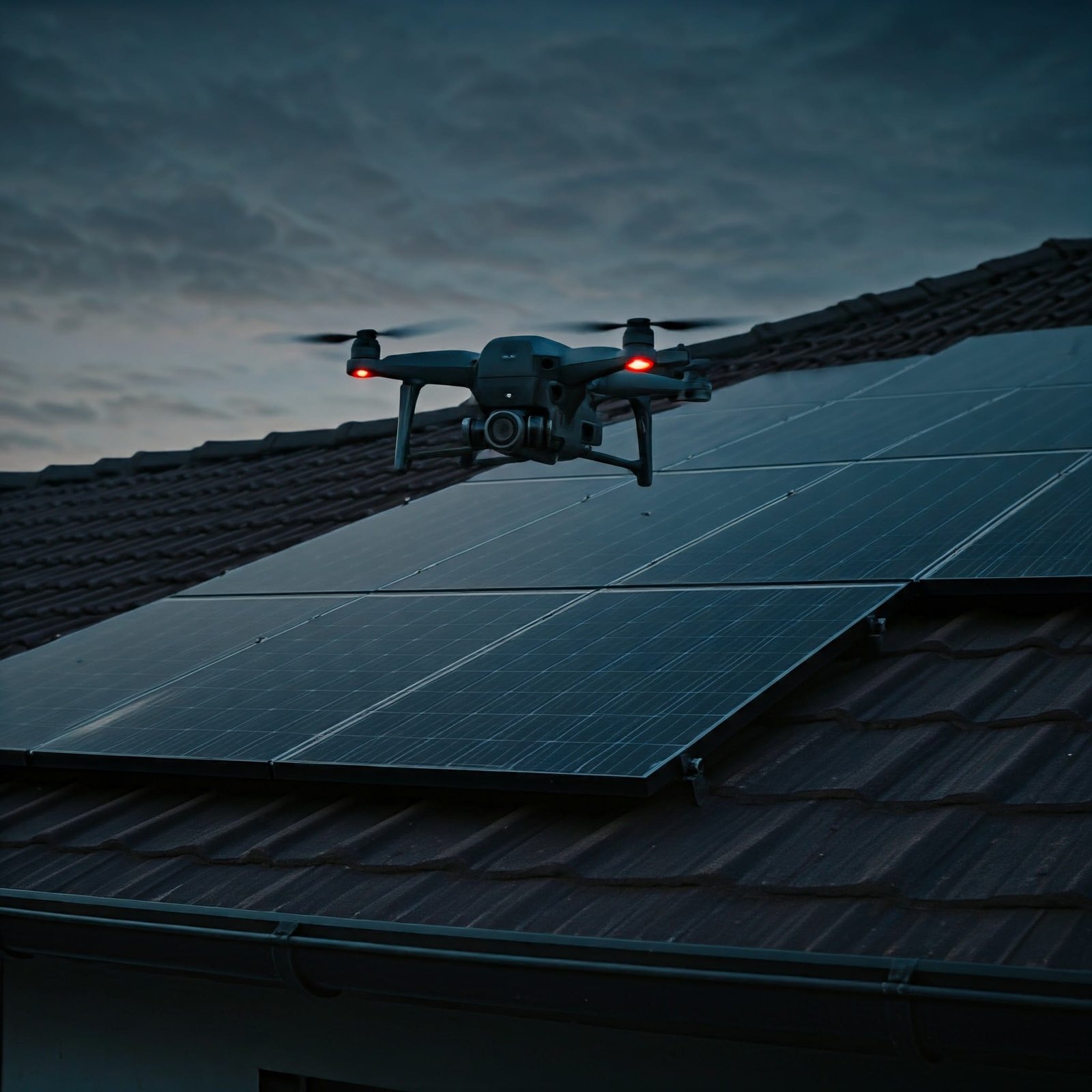
Drones can quickly assess damage after a storm by capturing high-resolution photos and videos of roofs, gutters, and exterior areas. This rapid documentation helps homeowners submit accurate insurance claims or plan repairs without waiting for traditional inspection teams. Ideal for the Southwest’s unpredictable weather patterns, drone-based storm inspections offer a fast, efficient way to understand your property’s condition and take action sooner. Visit our Inspection Services Page for more info.
2. Property Inspections
Routine inspections made simple. Drones can capture high-quality images of hard-to-reach areas, including chimneys, roofing, gutters, and even solar panels, giving homeowners an easy way to track the condition of their property over time. Avoid the hassle and risk of ladders or scaffolding—drones allow for safe and efficient inspections that quickly reveal areas needing attention, whether for routine checks or post-storm assessments. See our Aerial Inspections Services for more info.
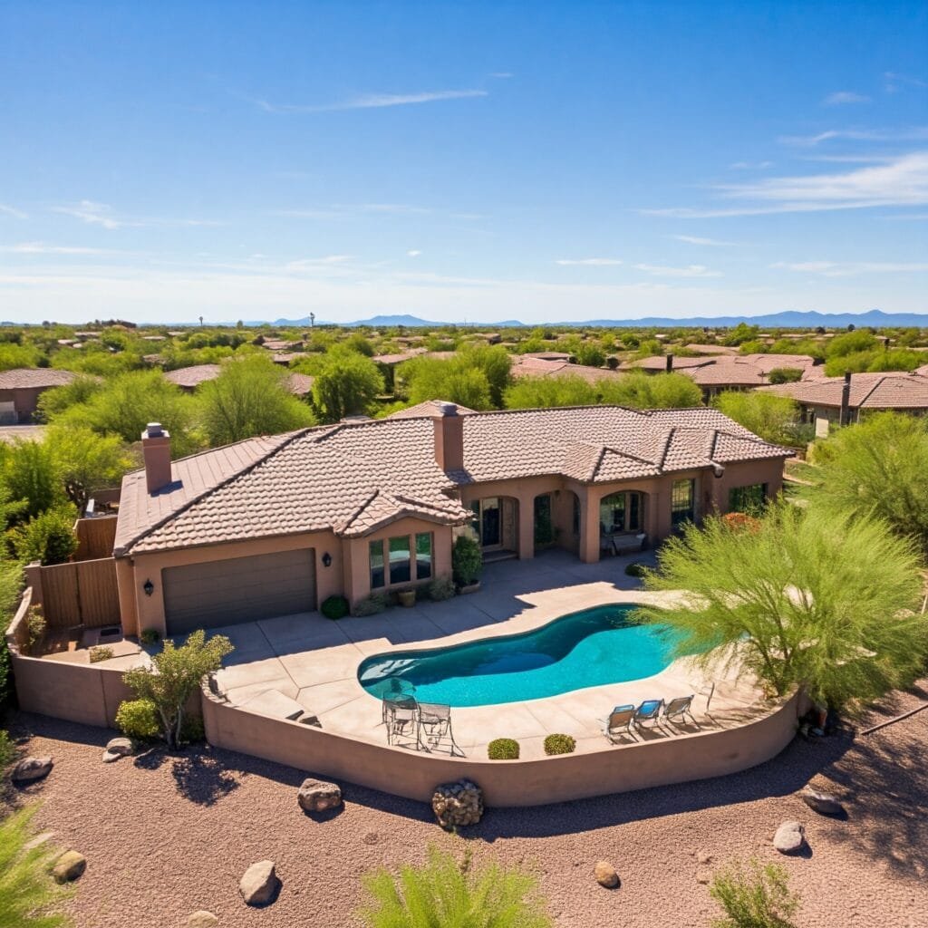
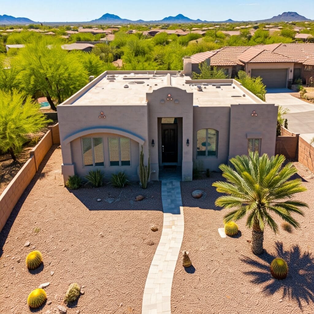
3. Aerial Photos for New Homeowners
Celebrate and document your new home with high-resolution aerial photos that capture every angle of your property, from desert landscaping to unique architectural details. Perfect for new homeowners who want keepsake images of their property, these aerial views offer perspectives that ground-level photography simply can’t achieve. Aerial shots are also great for sharing with friends and family to show off your new Arizona home in a truly memorable way. Check out our Aerial Photography Services for more info.
4. Virtual Tours
Drones offer the ability to create immersive virtual tours, perfect for Arizona homeowners wanting to document their space in a comprehensive, shareable format. Virtual tours are ideal for new homeowners looking to share their home with loved ones or established homeowners proud of recent renovations and improvements. These tours add a unique perspective and are a creative way to capture memories of your home. Explore our Video Services for more info.
5. Landscaping and Outdoor Design Visualization
Get a complete aerial view of your outdoor areas to aid in landscaping and design planning. Drones can create panoramic and mapping images that show the layout of your property, providing a helpful overview for landscaping projects, garden planning, or outdoor renovations. Ideal for homeowners looking to enhance their outdoor spaces, this service offers a bird’s-eye view of your property to help you plan with confidence.
6. Real Estate and Home Marketing
For Arizona homeowners ready to sell, high-quality drone photos and videos can make a real estate listing stand out. Drones provide a full view of the property’s setting, surrounding landscape, and unique features. These aerial images create a stronger visual impact than ground-level shots, helping your home attract more potential buyers and giving it an edge in a competitive market. Check out our Real Estate Services for more info.
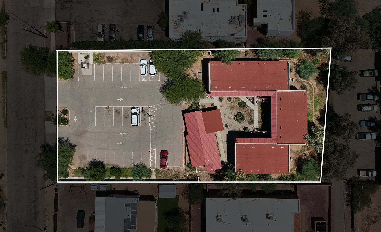
7. 3D Modeling and Mapping
3D drone mapping offers Arizona homeowners an accurate representation of their property’s layout, ideal for planning landscaping changes, renovations, or understanding larger properties’ layouts. This service generates detailed 3D models that help visualize your space in a new way, allowing for precise measurements and clear visualization that are valuable for large projects. Visit our 3D modeling & mapping services to learn more.
8. Event Photography for Family Gatherings
Capture special moments from a whole new perspective with drone event photography. From family gatherings to backyard celebrations, aerial photos and videos provide a unique way to commemorate special occasions. This service is perfect for those who want to add a memorable, creative touch to their event memories and capture gatherings in a fresh, engaging way. Explore our Party & Event Services for more info.
9. Insurance Documentation
Drone-based insurance inspections provide detailed, objective images for underwriting and claims. This service makes it easy for Arizona homeowners to gather comprehensive data on their property’s condition, ensuring that they get accurate insurance assessments. From annual updates to post-damage inspections, drones help streamline insurance processes and support fair claims evaluations. Find out more about our Insurance Industry Services.
Conclusion
Homeowners in Arizona can unlock the full potential of their properties with Southwest Drone Tech LLC. Our drone services make property management easier, help you create unforgettable memories, and boost your property value. Whether you need routine inspections, stunning aerial photography, or detailed environmental monitoring, our innovative technology provides a fresh perspective that simplifies essential tasks. Don’t miss the opportunity to enhance your property experience with our expert services. Visit our ALL SERVICES PAGE today to see how Southwest Drone Tech LLC can assist you in meeting your unique needs in Tucson, Phoenix, and beyond!
Southwest Drone Tech LLC Disclaimer
While Southwest Drone Tech LLC excels in aerial data collection, it is important to note that we do not provide interpretations of survey-grade information. For projects where precise measurements are essential, you must consult a licensed land surveyor or survey engineer. We can collaborate with your surveyor to supply valuable data, but our services do not replace the need for a licensed land surveyor in any jurisdiction.
We do offer visual markers or outlines of property areas in our imagery as part of our packages; however, these are for general visual reference only and are not legally binding or survey-grade. This standard applies universally to all drone data collection services unless they employ a licensed surveyor. We do not provide formal boundary delineations for home lots (whether developed or undeveloped) intended for sale due to these limitations.