
Sell Tucson Land Faster with Drone Photography
If you’re trying to sell raw or vacant land in Tucson, relying on blurry phone photos won’t cut it. Buyers scroll right past listings without compelling visuals showing the land’s shape, views, and access.
Drone photography instantly changes that by showcasing your parcel’s best features — helping your listing stand out in Tucson’s competitive land market.
Why Most Tucson Land Listings Don’t Sell Quickly
Look through Tucson land listings and you’ll see a common problem: uninspiring, low-quality photos showing little more than dirt or fences.
Without clear aerial context, buyers can’t picture the property’s full potential — especially those searching remotely or investing sight-unseen.
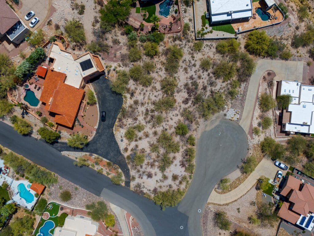
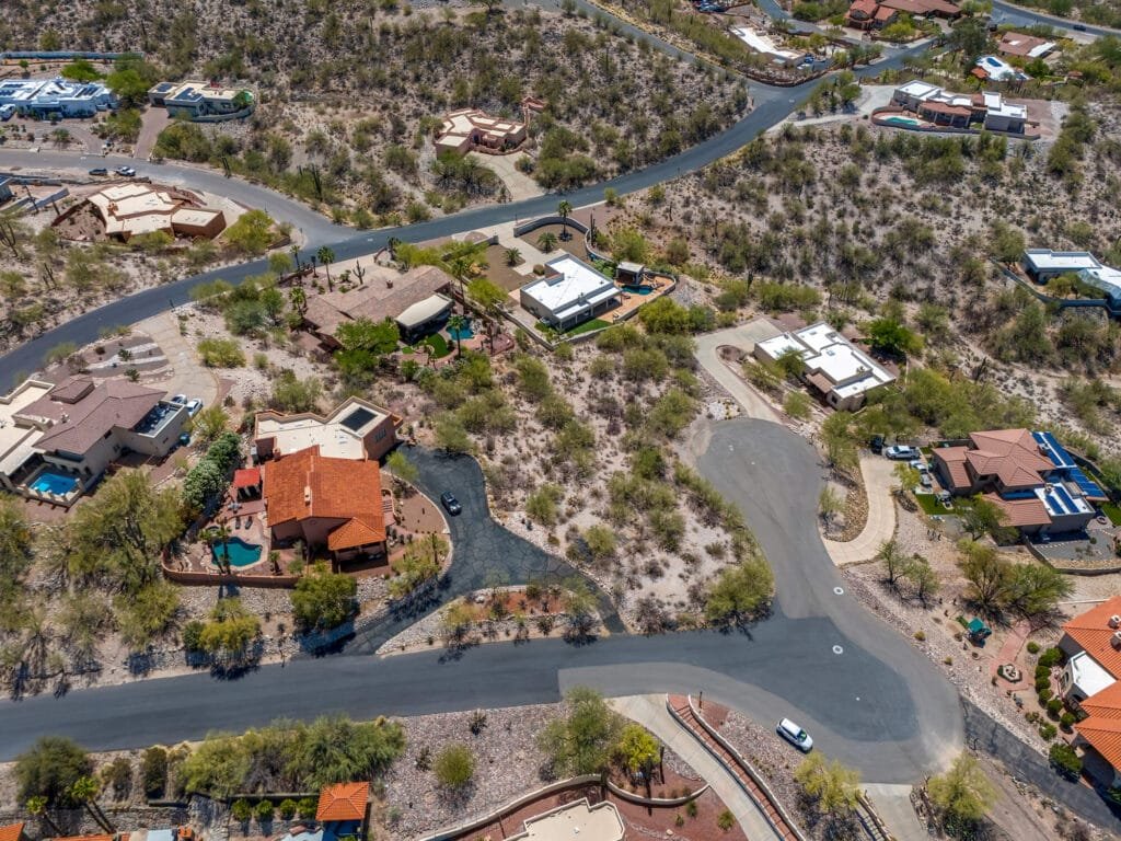
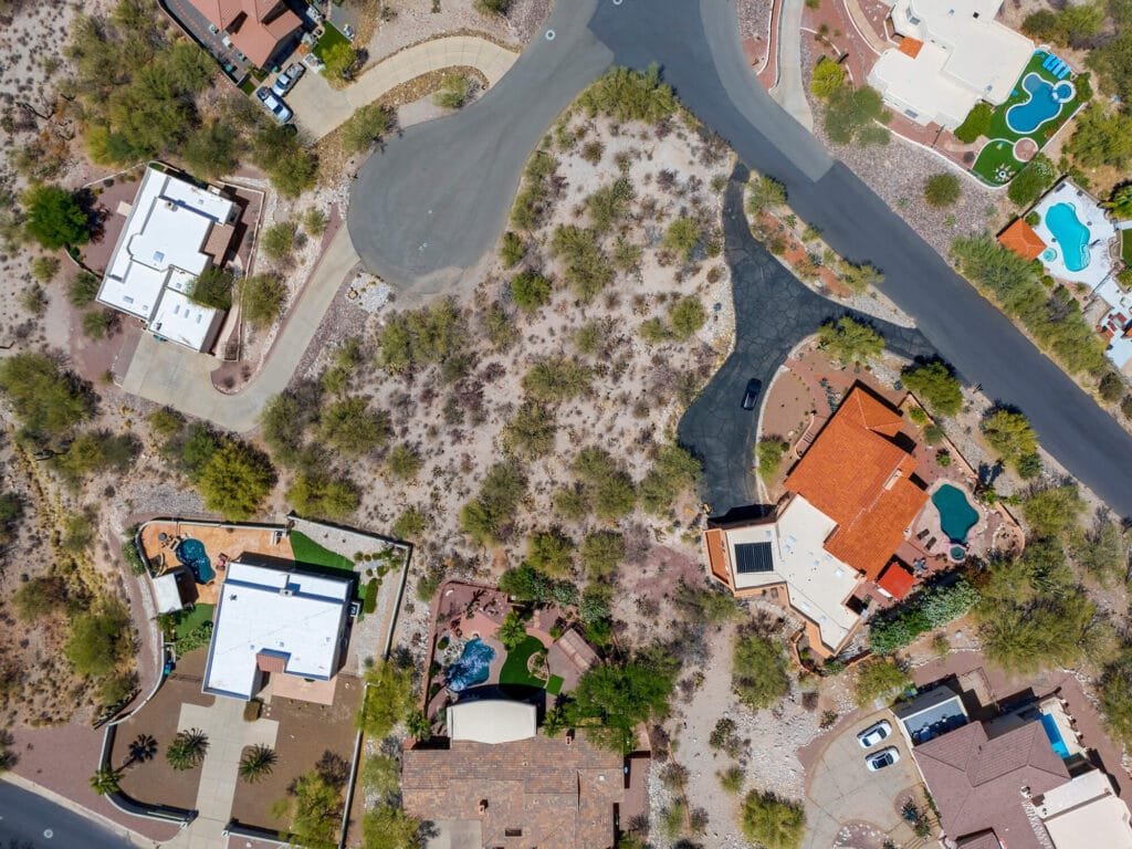
Drone photos deliver the whole story from above, giving buyers everything they want to know — terrain, boundaries, access, and surrounding views — all in one shot.
What Drone Photography Adds to Your Listing
- Complete aerial context: Lot shape, slopes, vegetation, nearby roads, and surrounding neighborhoods are clear at a glance.
- Highlight unique features: Mountain views, washes, desert flora, and natural landmarks pop from the sky.
- Boost buyer confidence: High-quality visuals help buyers trust the listing and inquire faster.
One client near Picture Rocks thought his parcel looked “plain” until drone shots revealed stunning Tucson Mountain views — he received serious offers within days.
Why Tucson Land Listings Benefit Most from Drone Marketing
Tucson’s natural beauty and diverse terrain mean aerial views are essential:
- Show slope and elevation changes clearly
- Illustrate distance to utilities and roads
- Highlight proximity to major landmarks like I-10 and Catalina Foothills
- Emphasize access to growing communities such as Vail, Marana, and Oro Valley
For land near Tucson’s key corridors, drone imagery tells a story no ground photo can.
Comprehensive Drone Services for Tucson Landowners
At Southwest Drone Tech, we offer a full suite of professional drone services designed to showcase, document, and market your raw land with precision and impact. Whether you need stunning visuals for listings or detailed data for development, our expert team provides everything you need to get results.
Aerial Photography — Capture high-quality photos to highlight land features, boundaries, and terrain for sale listings or marketing materials.
Aerial Videography — Dynamic video flyovers and parcel walkthroughs that give buyers a true sense of the property’s size and surroundings.
Mapping & Orthomosaic Imaging — Accurate maps and stitched images perfect for land surveys, development planning, and condition reports.
Inspections — Detailed aerial inspections to assess land conditions, access roads, utilities, and any potential issues before purchase or development.
FPV Drone Services — First-person view drone footage providing immersive, fast-paced visuals ideal for promotional videos and dynamic land showcases.
Photo and Video Editing — Professional editing services that enhance your images and footage, ensuring your listings stand out with polished, sale-ready content.
Each service is tailored to help you sell, develop, or manage your raw land efficiently with expert drone technology.
Selling FSBO? Gain a Marketing Edge With Drone Photos
Selling your Tucson land yourself? Stand out on Zillow, Craigslist, Facebook Marketplace, and LandWatch by adding professional drone photos. They bring clarity to your listing, attracting buyers who know what they’re getting — reducing wasted calls and speeding sales.
What Southwest Drone Tech Delivers
Aerial photos (before/after, progress updates) – land sales and marketing
Video flyovers and parcel walkthroughs – property development monitoring
Orthomosaic maps and 3D models – parcel documentation and condition reports
Detailed shots of terrain, roads, utilities, and boundaries – investor presentations and site analysis
High-resolution images for listings and marketing – bulk multi-parcel shoots for land management
Why Drone Marketing Speeds Your Tucson Land Sale
Drone photos help you:
- Close deals faster by providing all info upfront
- Attract qualified buyers who understand your property
- Minimize time-wasting inquiries and tire-kickers
- Present your land’s value more clearly than any text or map
Every month your land sits unsold costs you. Invest in drone marketing to sell smarter and faster.
Ready to Sell Your Tucson Land Faster?
Southwest Drone Tech delivers stunning drone photography and aerial imagery that showcases your property’s best features—perfect for developers, realtors, and landowners looking to attract serious buyers. Whether you’re marketing vacant lots or large parcels, our expert visuals help you stand out, speed up sales, and close deals with confidence.
Contact Southwest Drone Tech to boost your Tucson land listings.